I thought this was going to be a quiet year. We had no big trips planned, and the thought of being home for long extended times actually sounded good to me. That was not to be! Our RV was sitting in its storage spot feeling sad it wasn’t going anywhere. The price of gasoline was skyrocketing, and the thought of traveling the country just didn’t seem like a smart idea. Arizona summers can be brutal, and this was our first one to encounter. We had always left in May and returned in September or October. We missed the super hot monsoon season.
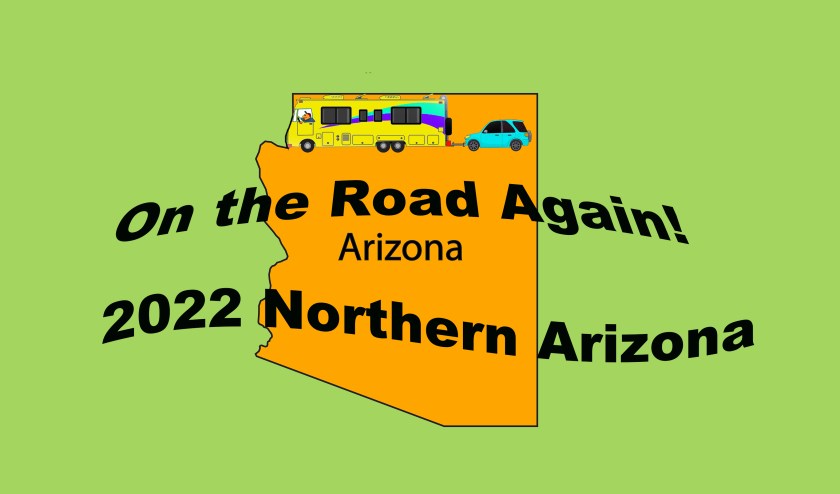
As we discussed the summer we decided to leave for a shorter trip in mid June, and also to make that trip only in Arizona. Dennis figured if we took the RV from our home to Page, Arizona for 2 weeks, and then drop down to Flagstaff for 2 weeks before arriving back home, we could do this trip on one tank of gasoline in the RV.
On Friday, July 15, we loaded the RV and headed our way to Page, Arizona. Page is on the northern border of Arizona next to Utah. It took most of the day to travel from our home in San Tan Valley. The next day we had no idea what we were going to do, so we decided to take a little ride around the town. Page is a small town with a population of around 7,500, and there isn’t much to see in the town. Most people come to Page to spend time at Lake Powell with their boats. We are not boating people, so that will not be our draw.
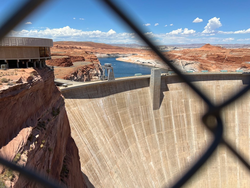
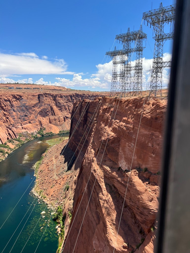
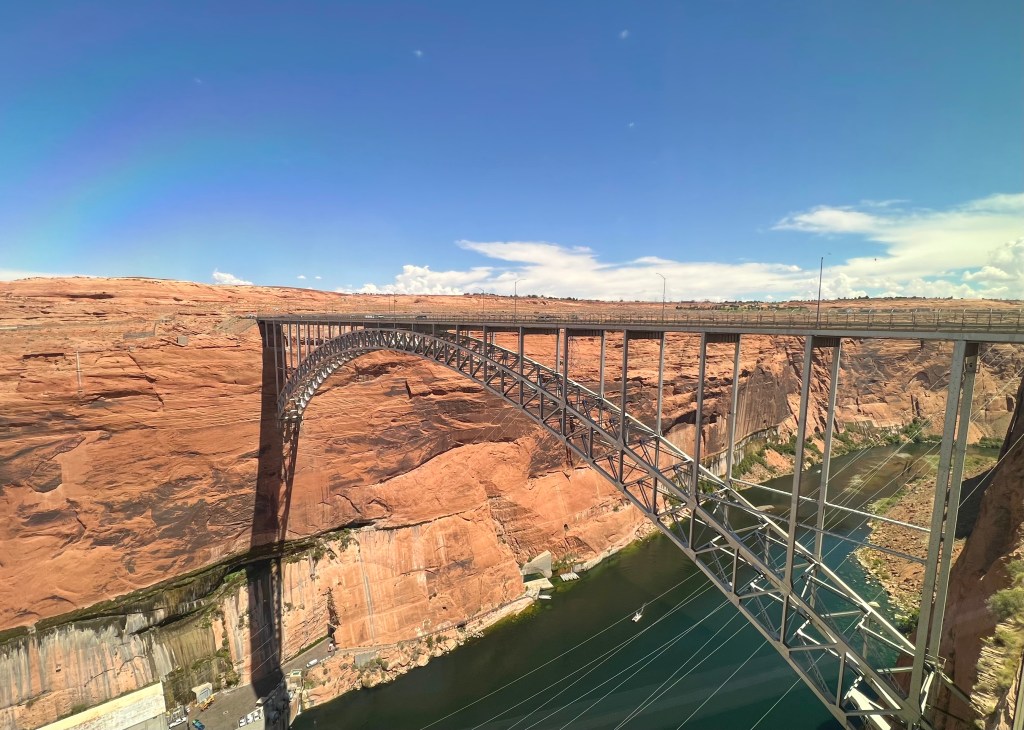
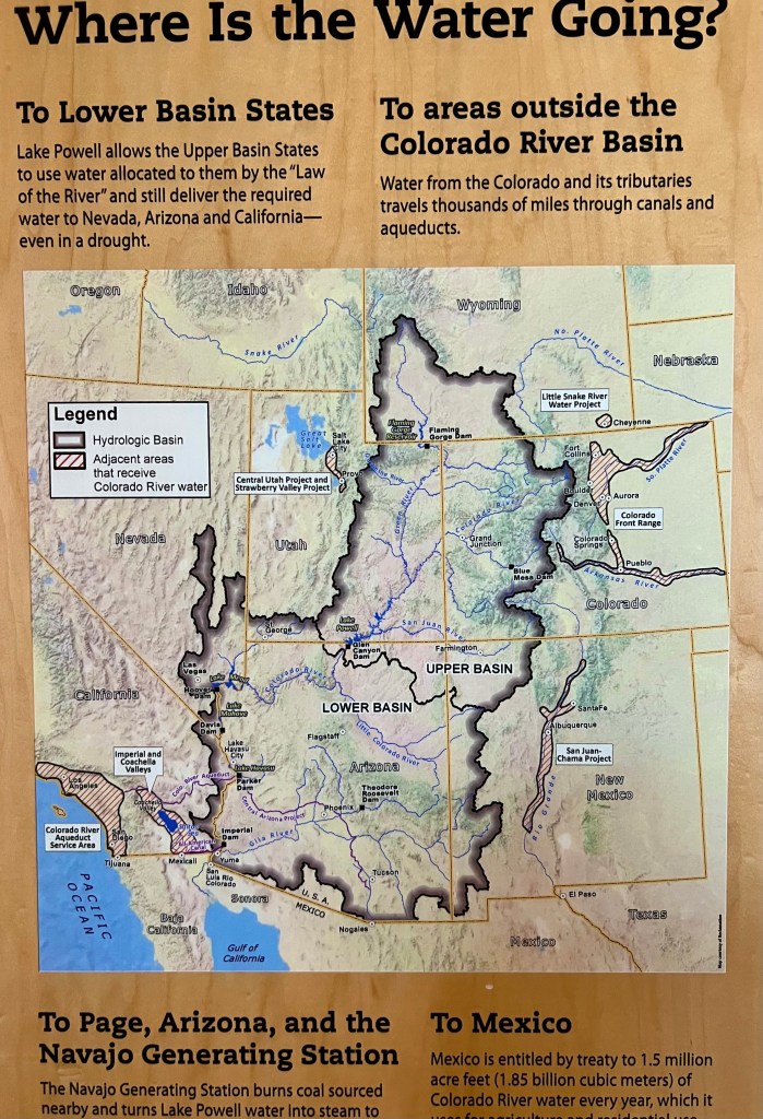
The first place we stopped with at the Glen Canyon Dam. This dam on the Colorado River is right on the border of Arizona and Utah. The dam was built in 1956 and is the 2nd highest concrete-arch dam in the United States, second only to Hoover Dam. Hydroelectric power is produced by the dam that provides electricity to Arizona, Wyoming, Utah, Colorado, New Mexico, and Nebraska. How did Nebraska get in the mix, you may ask? I have no idea, but this is what the website of the Bureau of Reclamation states about the dam. It’s their dam, after all. The water level is very low since Arizona has been in drought conditions for quite a while.
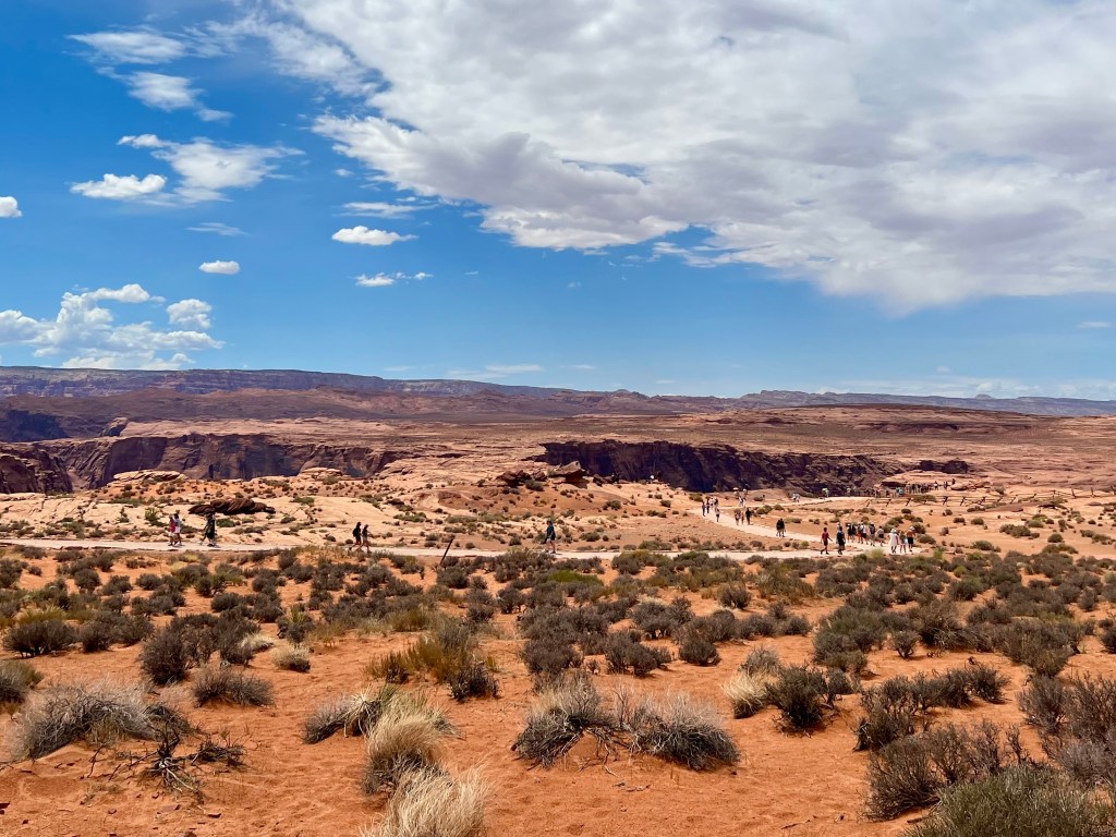
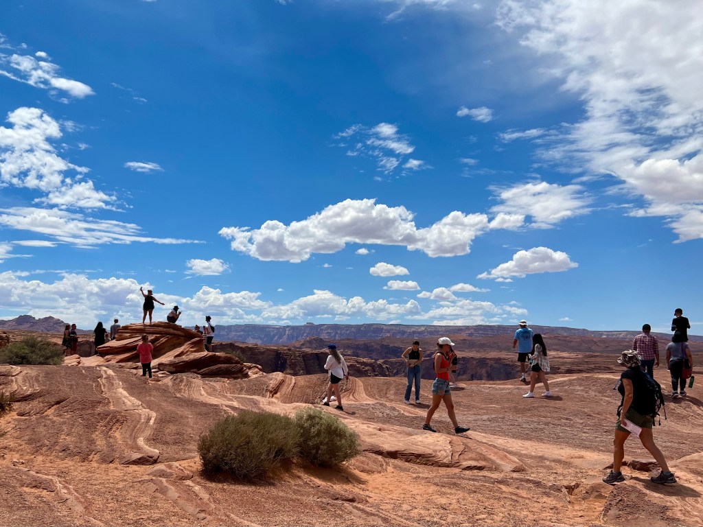
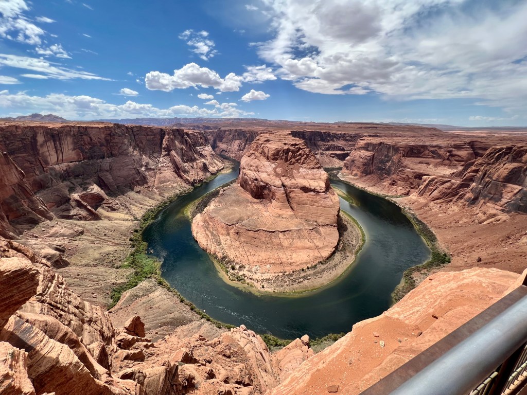
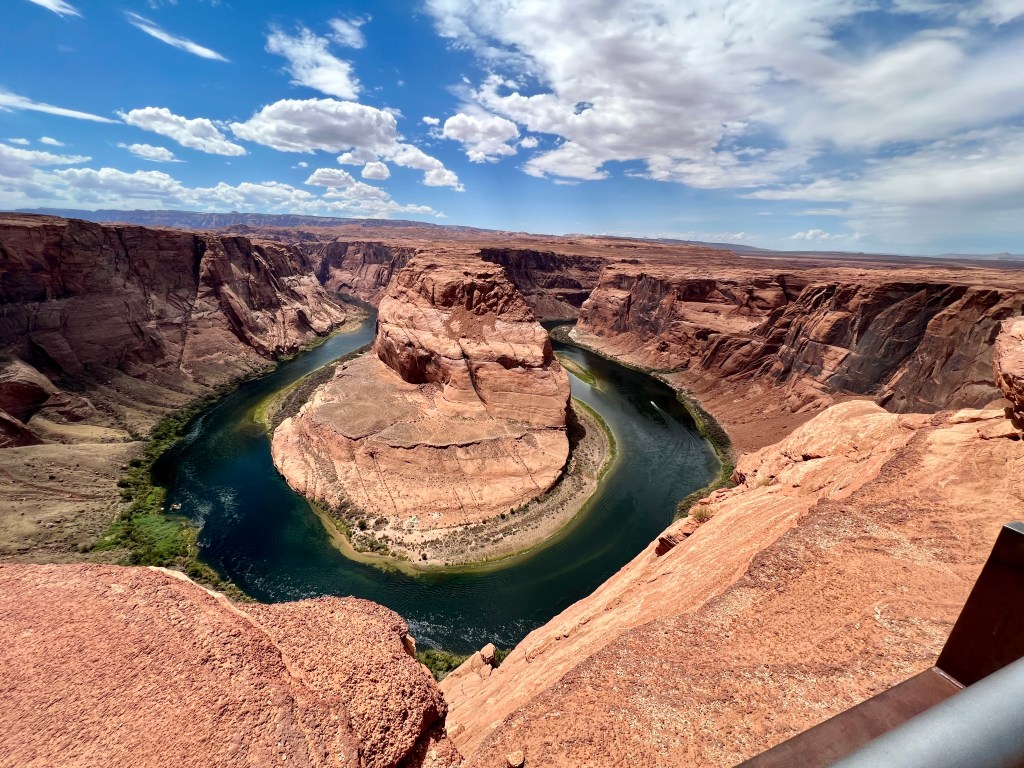
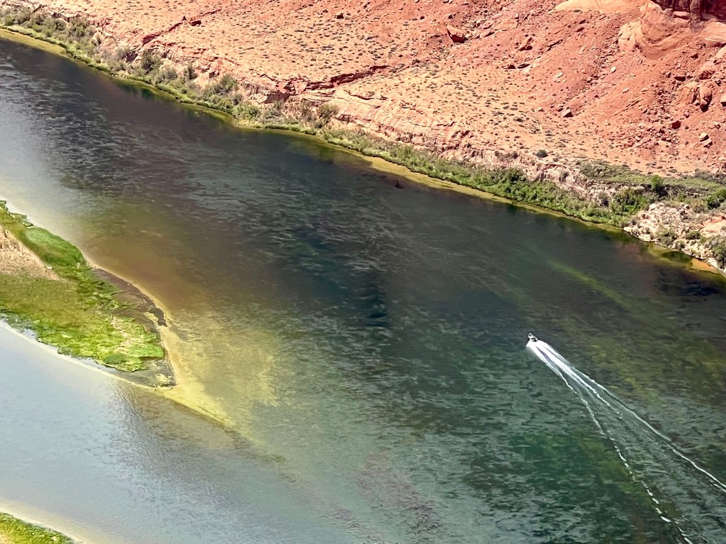
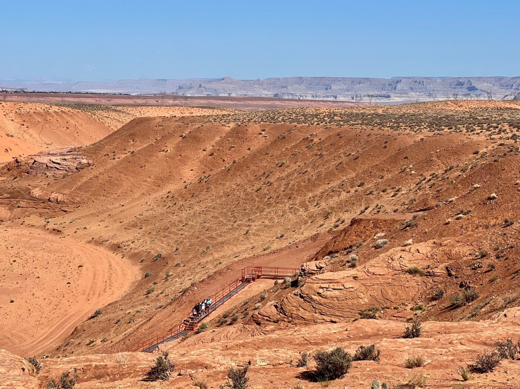
We went on to Horseshoe Bend. Not knowing what it really was, we weren’t fully prepared. It was hot, 100+ degrees, and we had a 3/4 mile walk to and from the site. Fortunately, they sold cold water at the gate. I also had sandals on because this stop was a spontaneous one and I was not prepared for any hiking. The walk on the path was fine, although I had to stop every so often to get the sand and small rocks from under my feet shaken out. Once we got there, it was a site to see. I’m not sure I would go back, but it needs to be seen at least once. The Colorado River is very low and makes the water in this part of Arizona look very green. I don’t know, maybe it always looks this color.
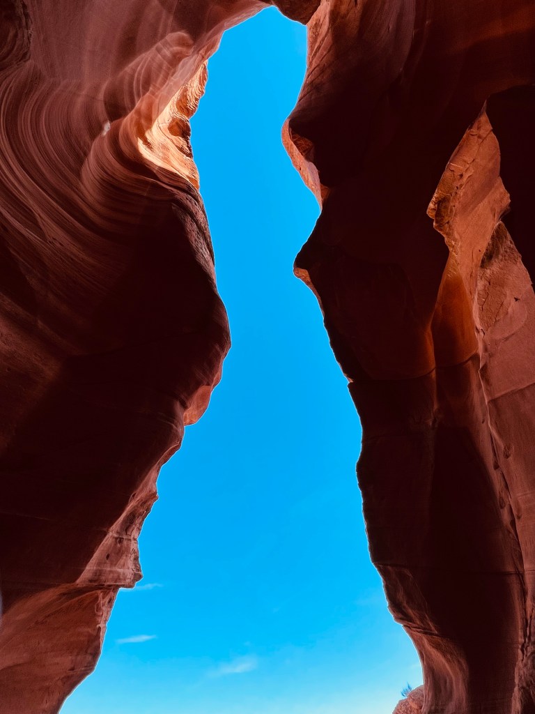
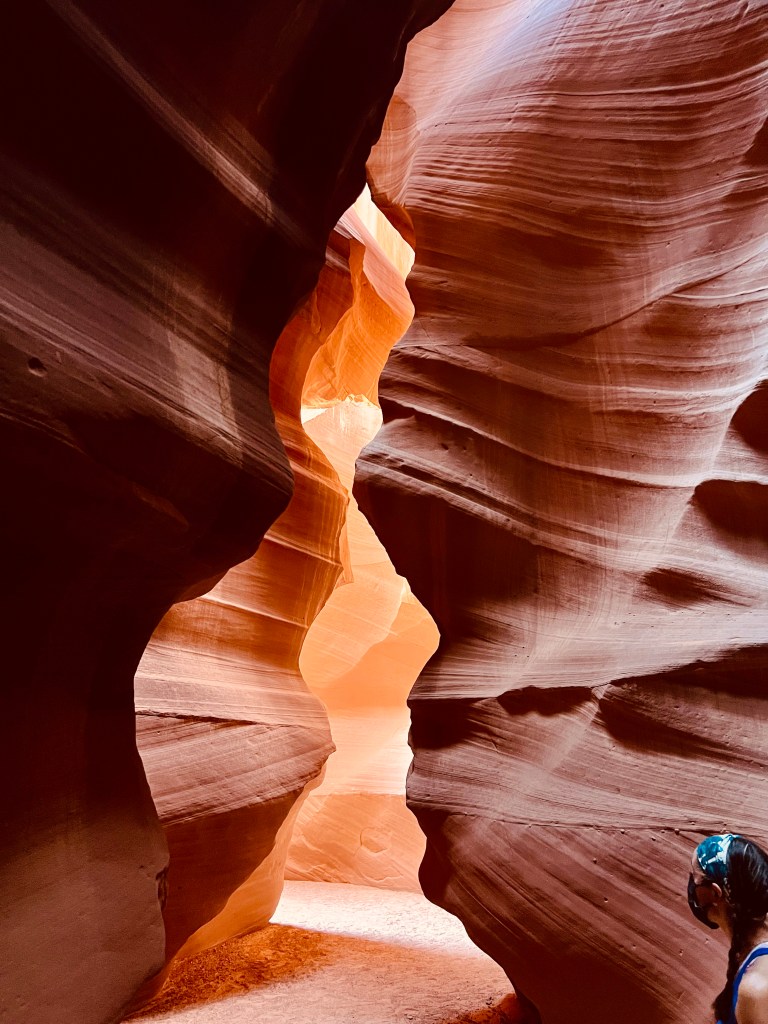
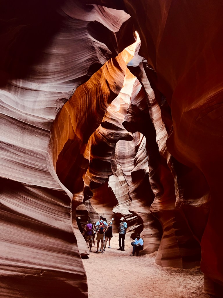
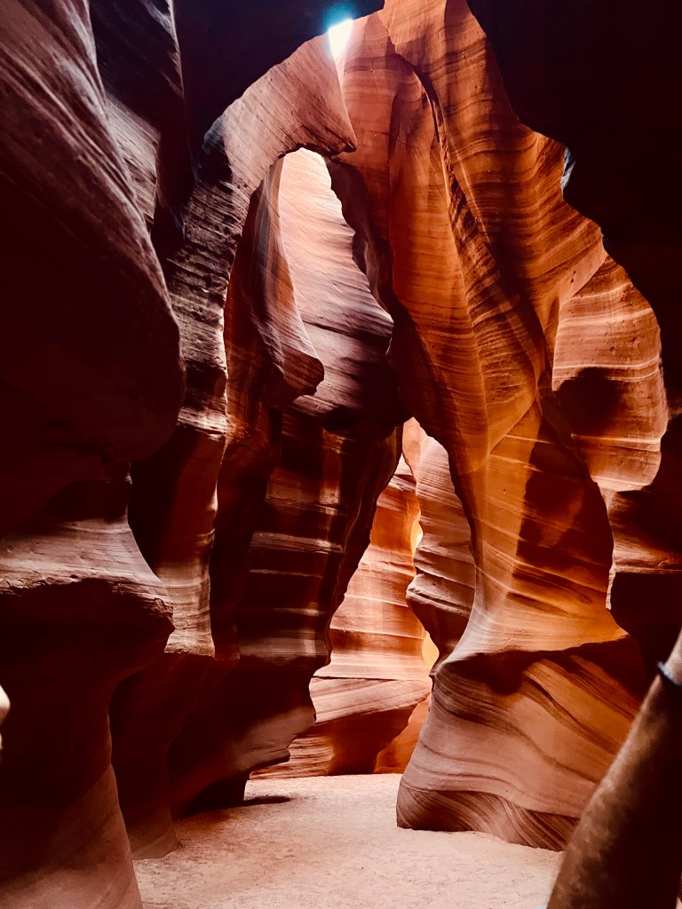
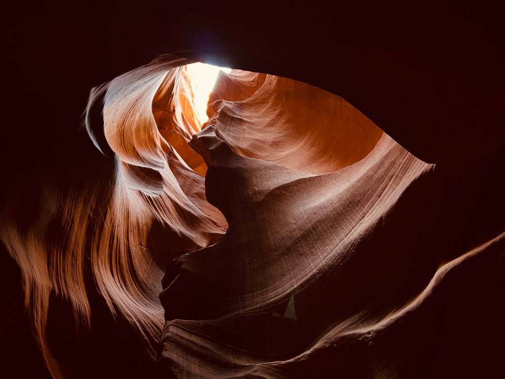
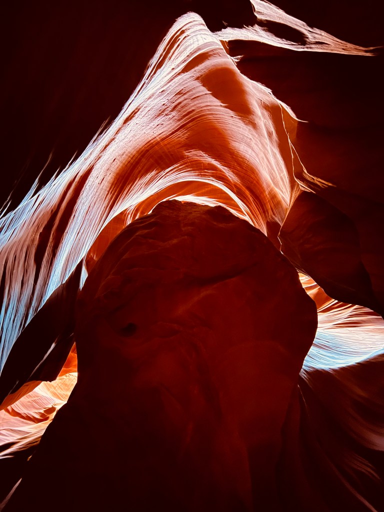
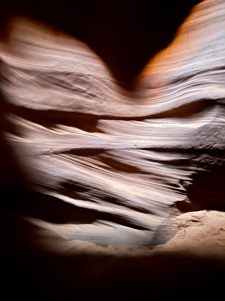
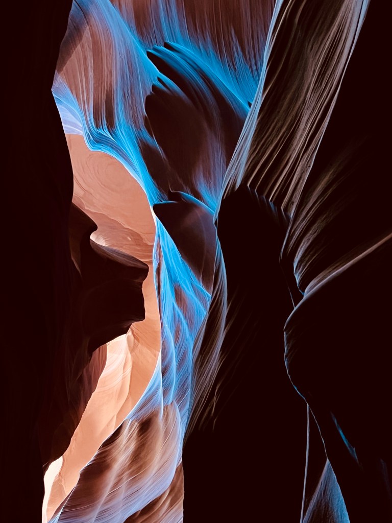
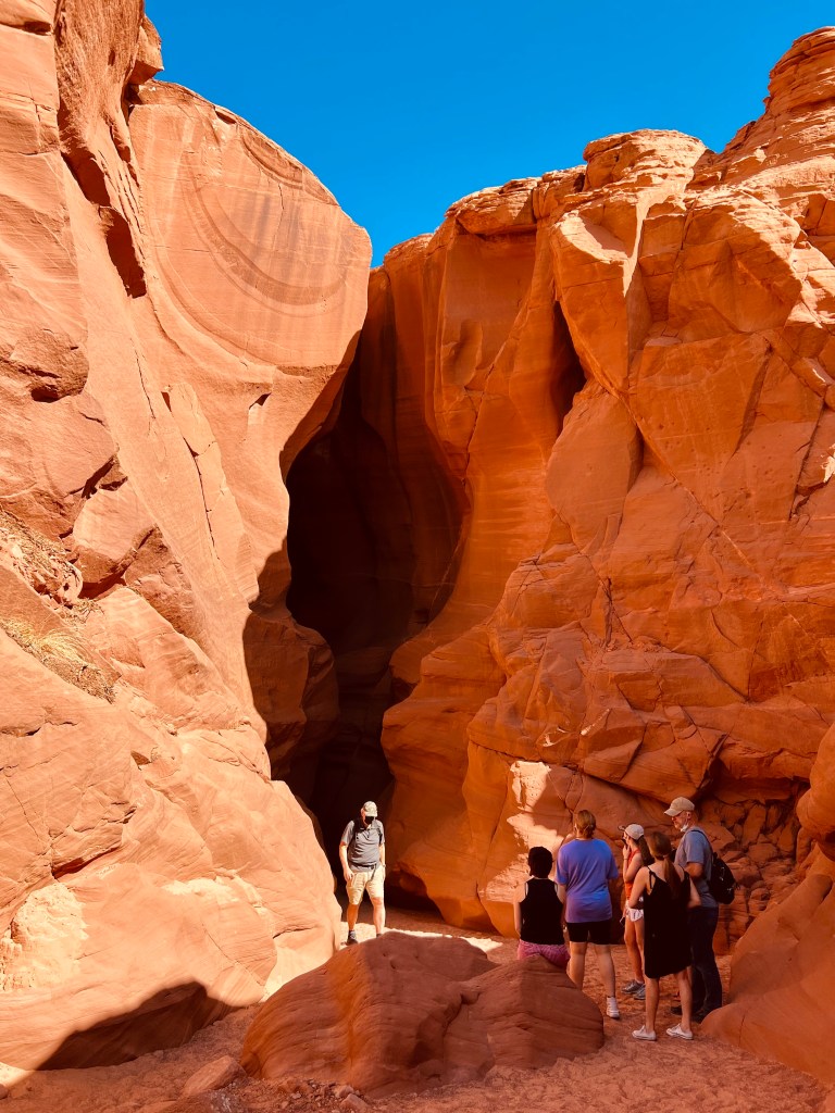
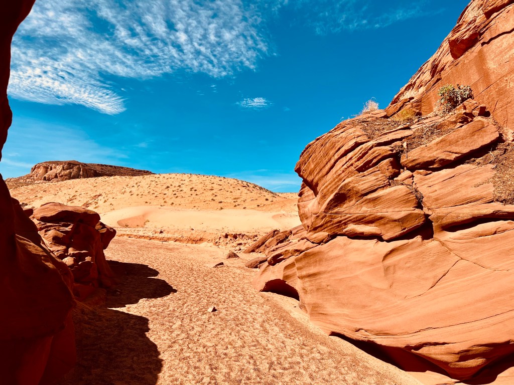
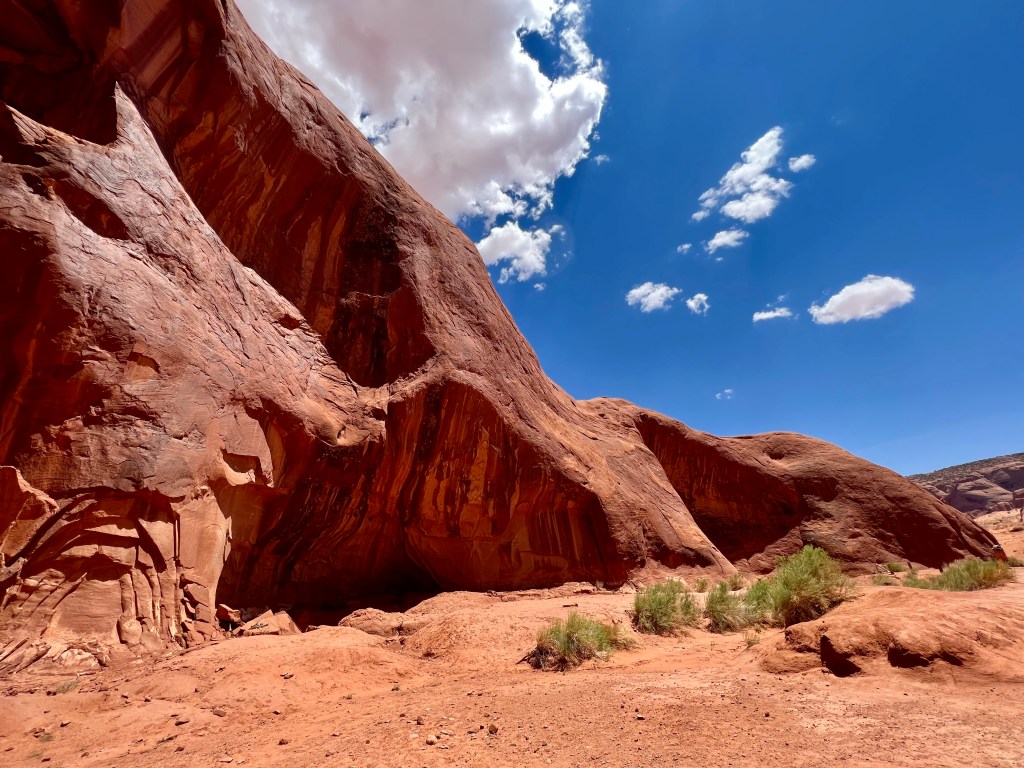
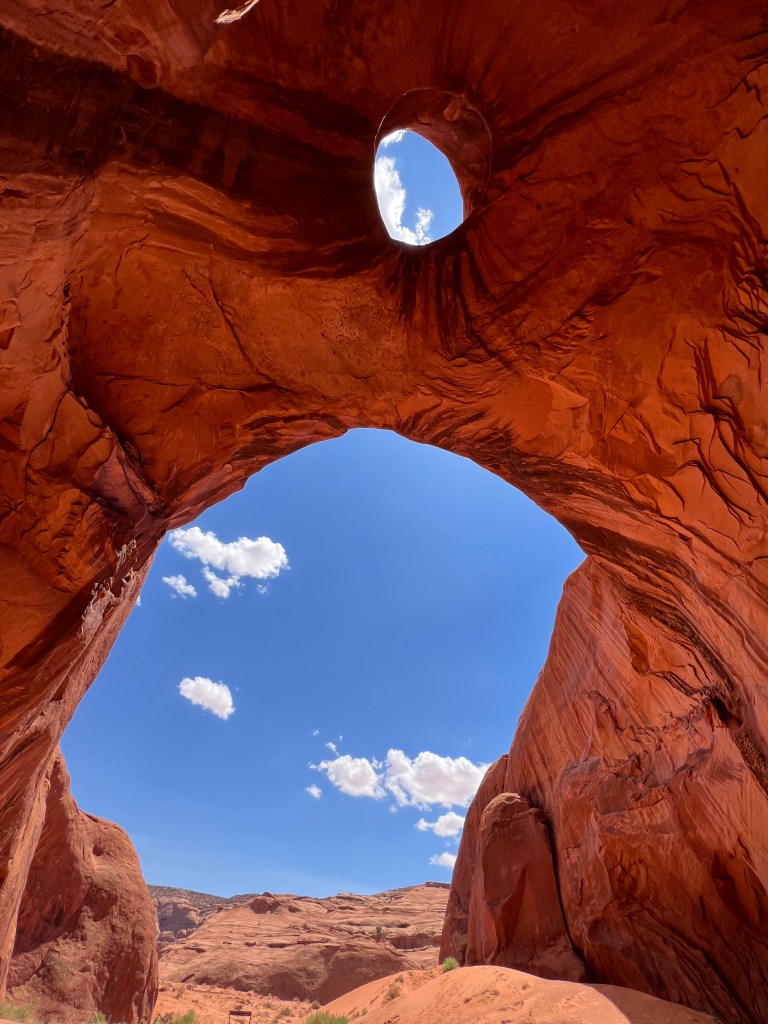
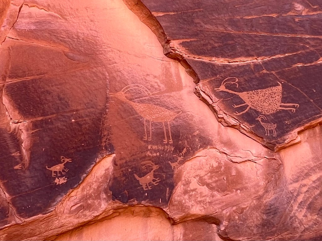
A few days later our next excursion was to Antelope Canyon. I know so little about this area, that I always thought Antelope Canyon was in Utah. It is in Arizona, and it is on Navajo Nation land. We signed up for a tour of the upper canyon. Face masks were required for this tour. As we loaded on the back of a truck with seats that faced to the right and left, we headed out to the canyon. Those face masks were handy, not because we were around people, but because the truck drove though the dusty desert to arrive at the canyon’s entrance.

What I did not realize is that these canyons were developed by rushing flood waters that literally washed away much of the flagstone and sand. Our tour guide said that the canyon is in desperate need of a good flood to bring the level of the canyon floor back down several feet from where it is now. Lynette, our Navajo tour guide, borrowed my camera/phone several times to show the group exactly where to stand and aim to get the best photo. I loved that she was taking the photos for me as I observed this beautiful phenomena of nature. The lighting thorough the cavern slits made awe inspiring photos.
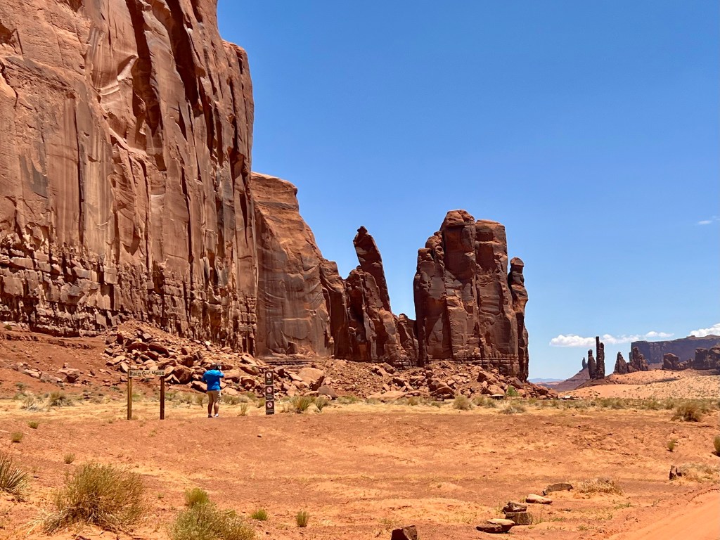
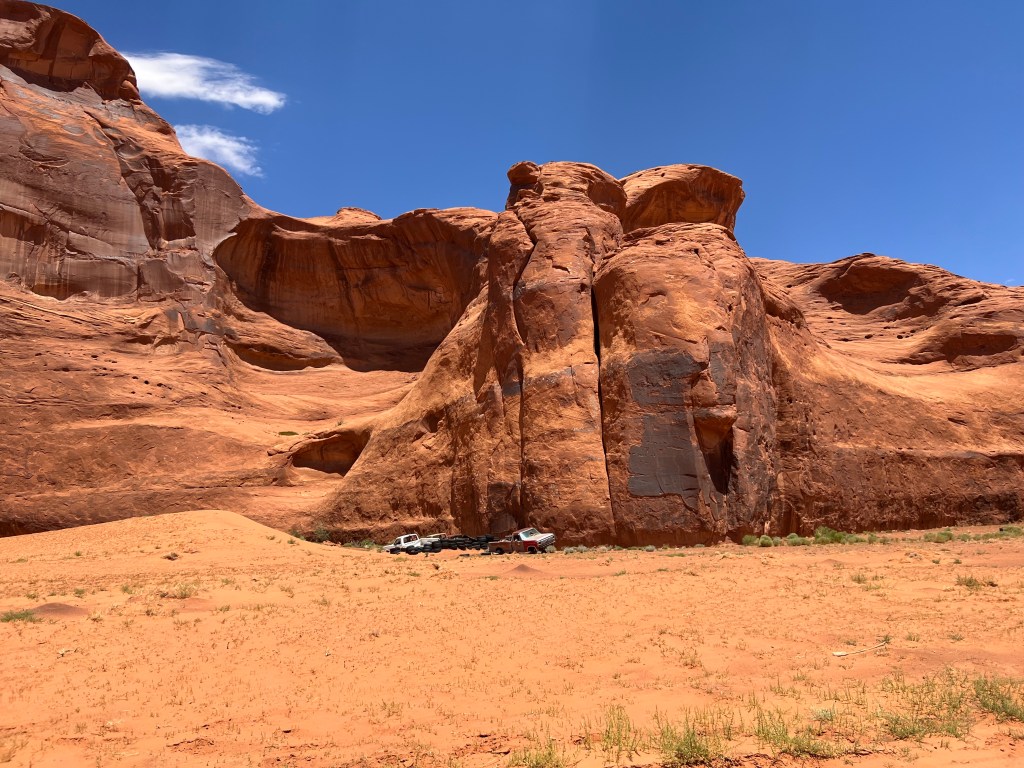
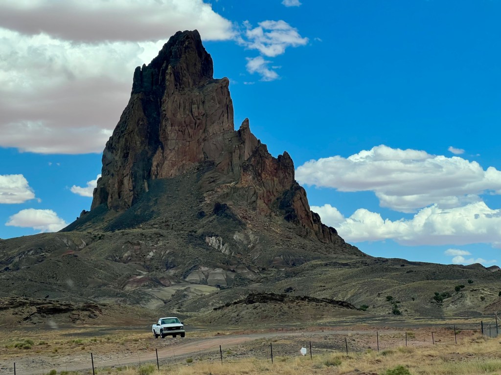
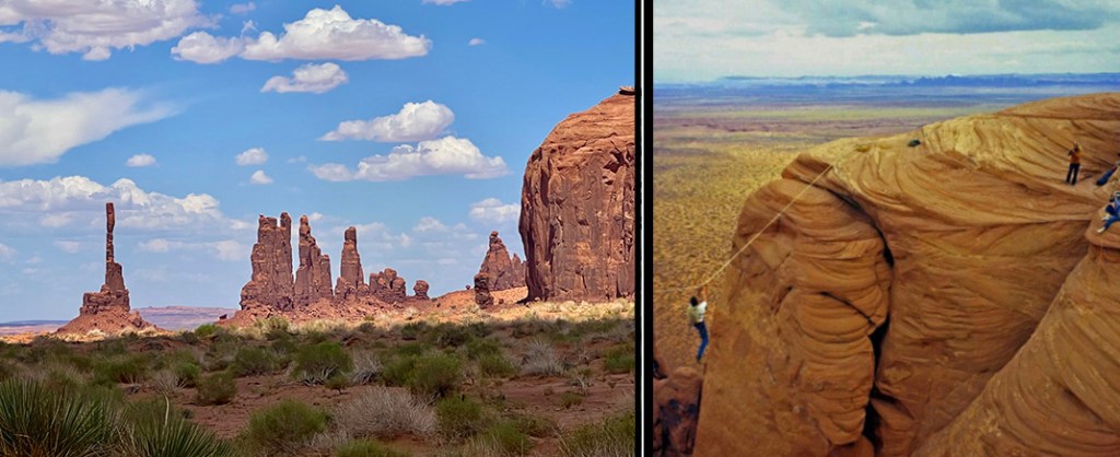
A huge portion of northern Arizona consists of Navajo land. Our next tour was to Monument Valley. Although it is a straight shot as the crow flies, there is no straight and direct way to get there. We signed up for a tour through a company called Spirit Tours. They claim to be a totally Navajo tour company that is more interested in sharing their culture than all the fame and glory of who visits this area, although it was touched on very briefly. They gave us GPS coordinates to find our way there, since they said typing the name would take us 300 miles in the wrong direction! It was a beautiful two hour drive to the location. The advantage of the tour, rather than driving through ourselves, is that most of the places we saw up close are in areas not open to the general public.
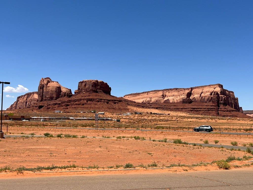
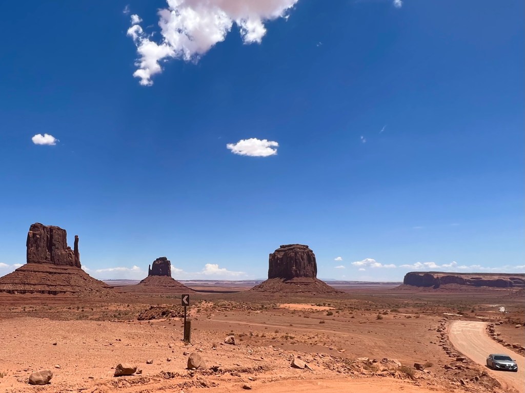
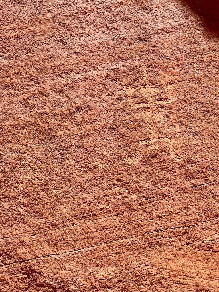
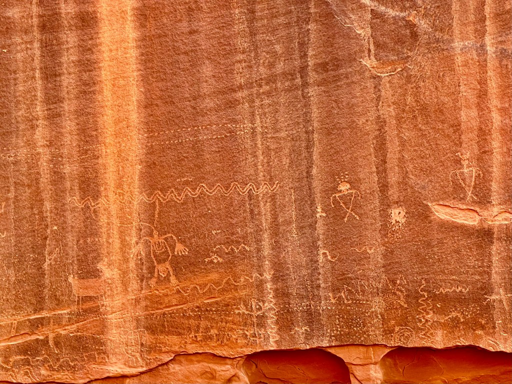
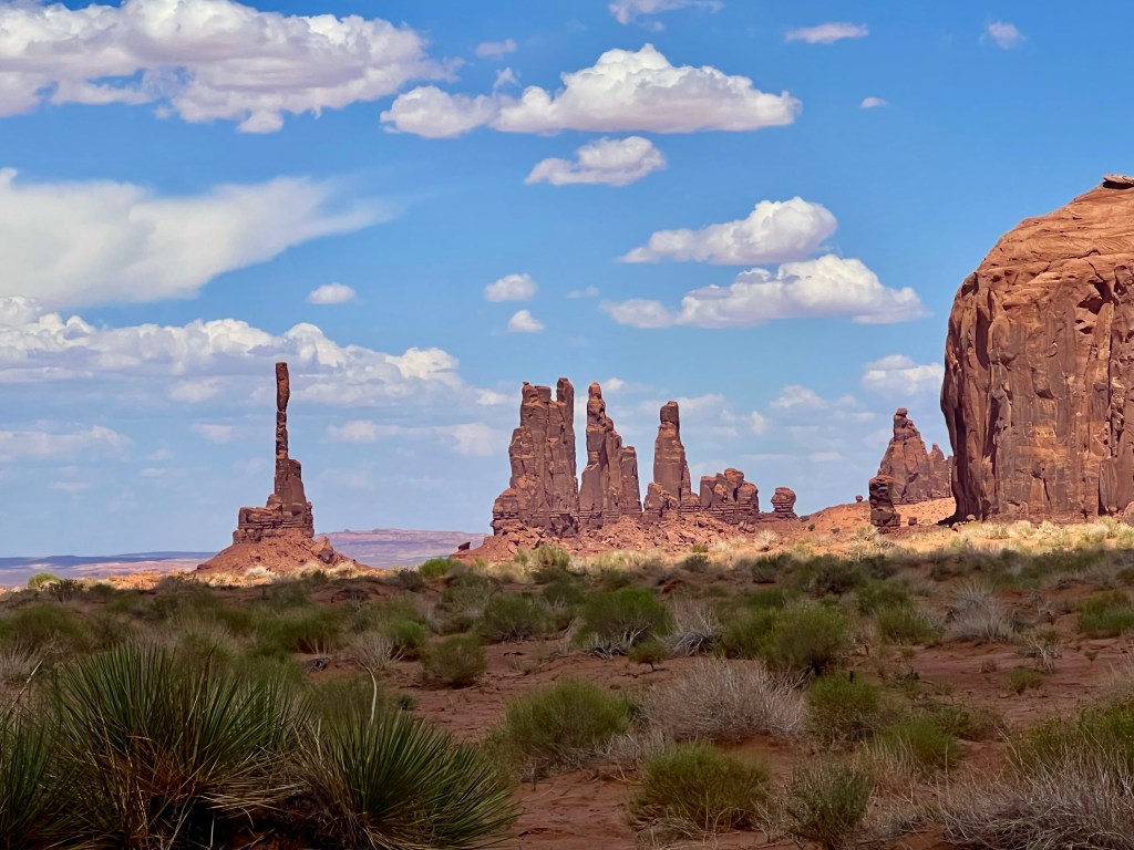
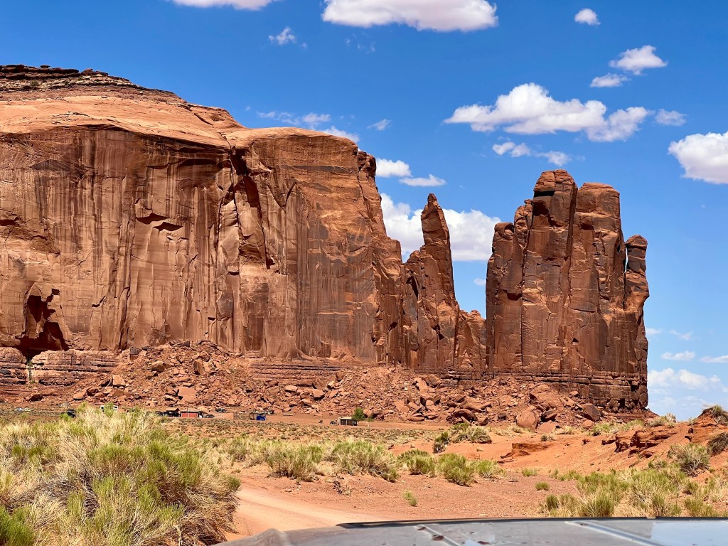
Many movies have been filmed at Monument Valley. The first was “Stagecoach” in 1939. My immediate thought was what the crew and actors thought when they had to meander throughout the desert to even find this place. It must have really been isolated 83 years ago. I am sure the two lane highways we took to get there were probably dirt roads. Of course, once they arrived, I am sure they were in awe just as we were when we arrived. You can actually look online for photos of these movies at Monument Valley.
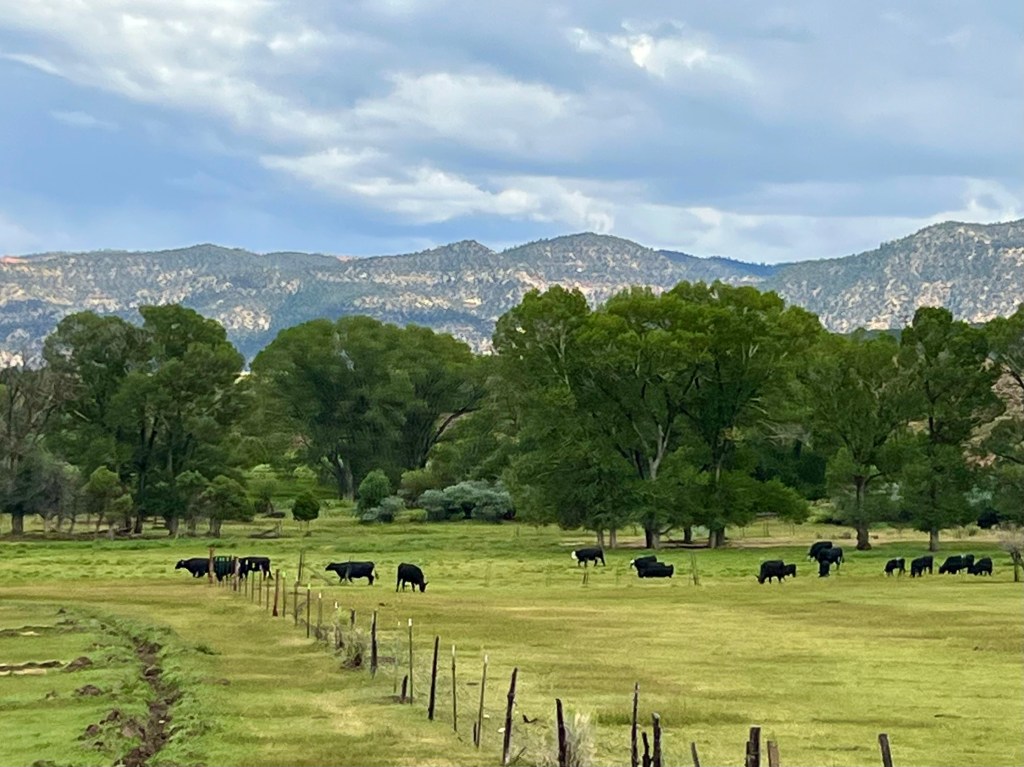
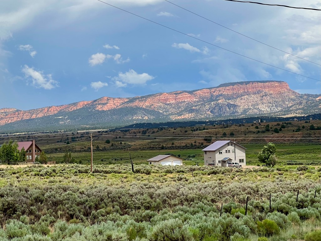
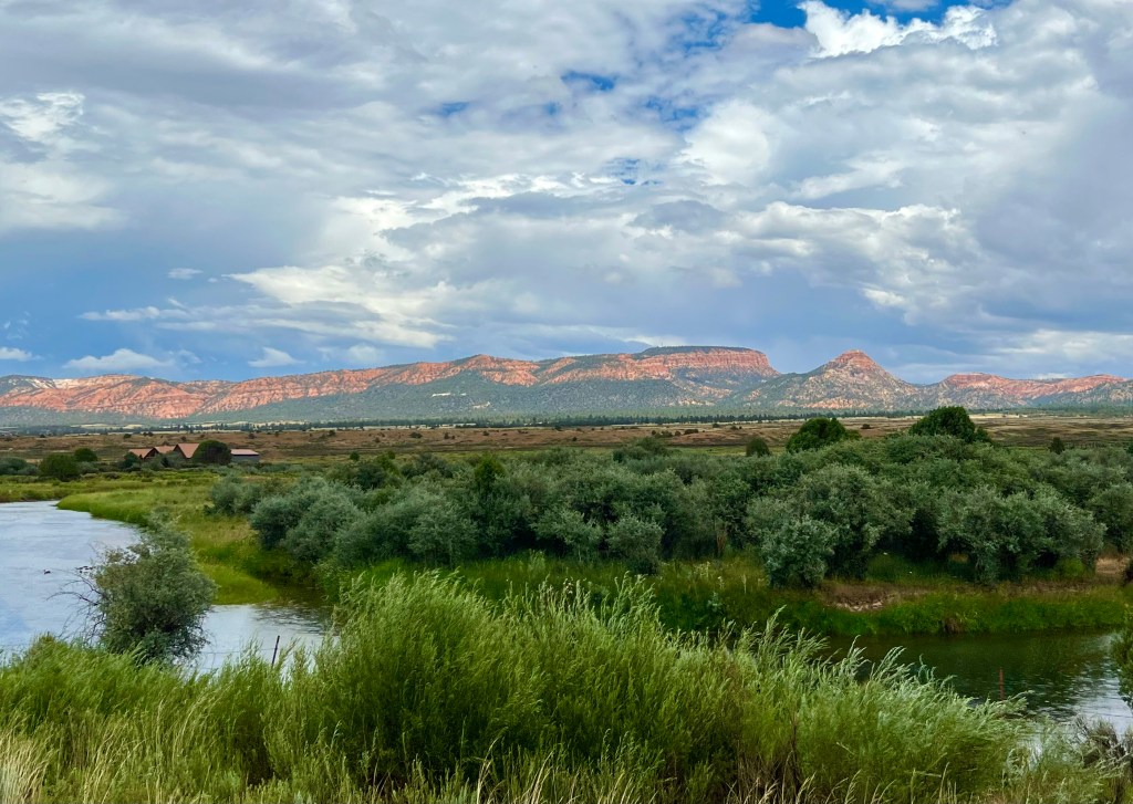
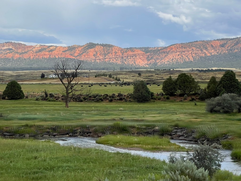
Having taken in sites in Arizona, it was time to head our way into Utah. We decided to take a drive to Bryce Canyon. I take a lot of photos while Dennis is driving down the highways. Sometimes I think I do better photography at 65 miles per hour than standing still. I love the scenery as we travel, and Utah definitely does not disappointment.
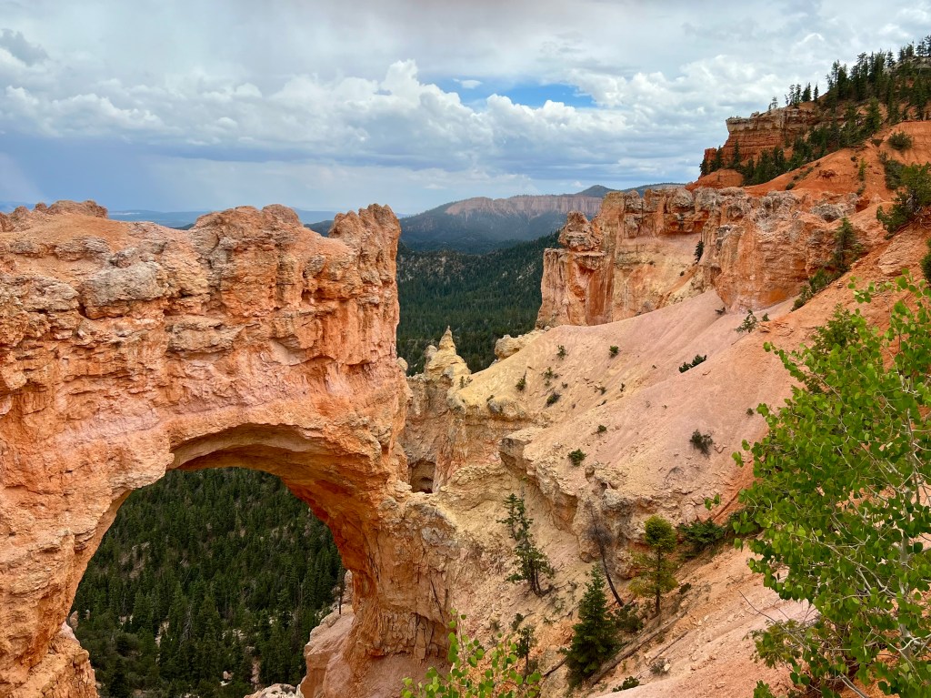
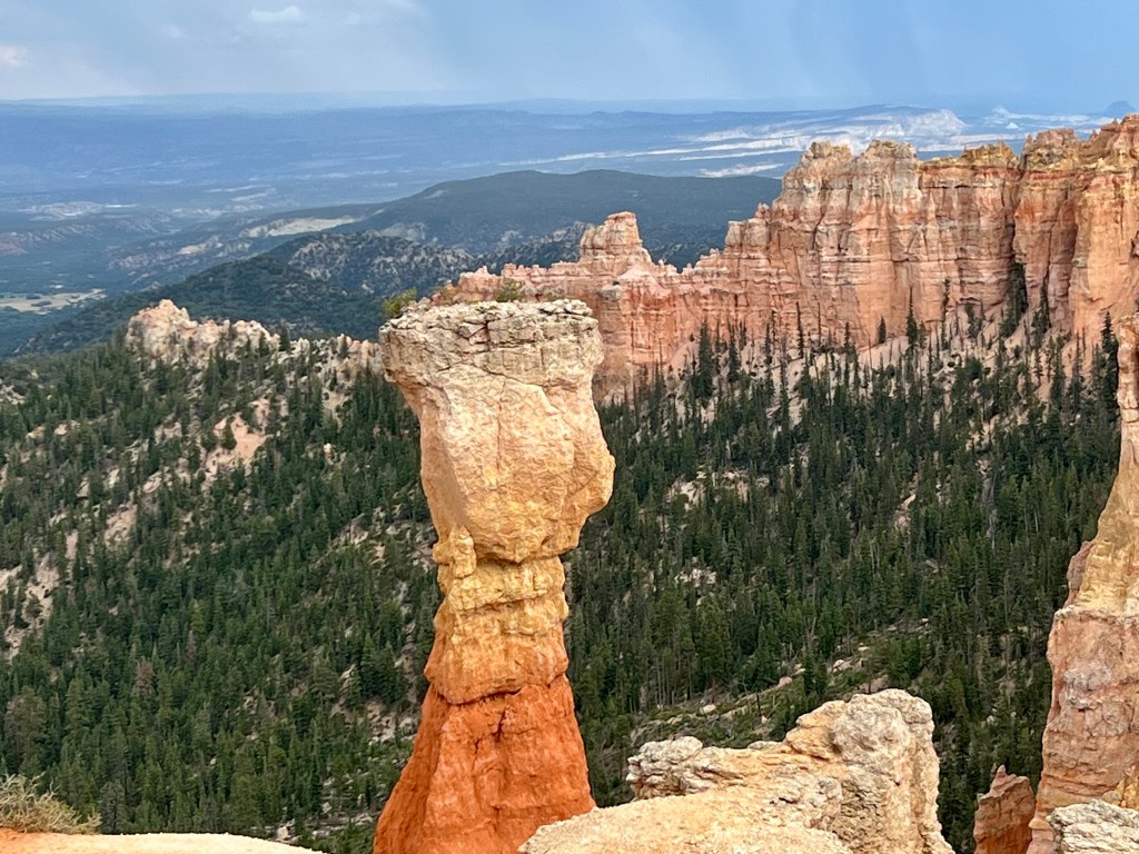
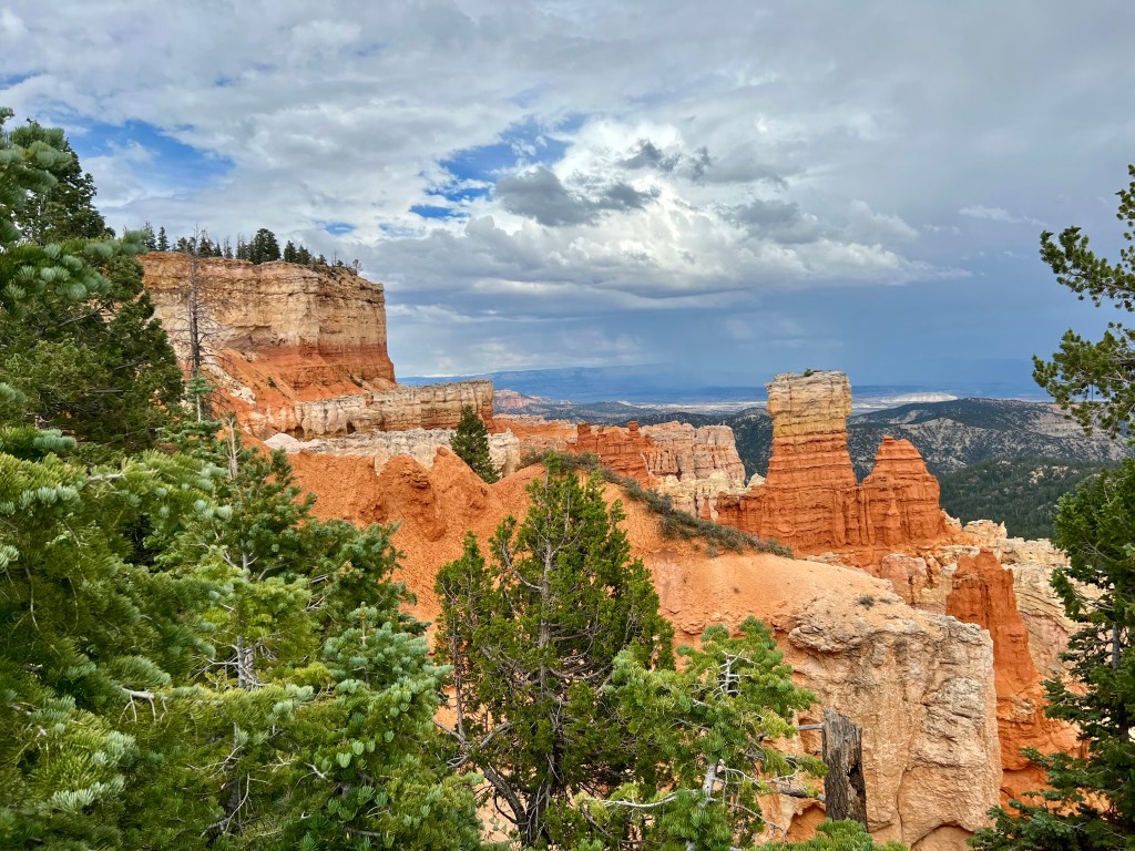
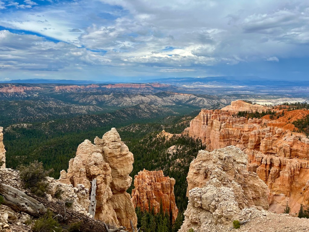
We were a bit unprepared. Although the temperature in Page was quite hot (only about 15 degrees cooler than the Phoenix area), Bryce Canyon’s elevation runs between 8,000 and 9,000 feet. There was a huge temperature difference. We arrived at the national park and drove to our first lookout point. It was overcast, so we grabbed our umbrella, and walked a short way to an overlook. Then I realized what this canyon was about. The rock formations were huge, red, jaggedy, and really deep. Just as we started to take photos, the heavens opened up and dumped a ton rain. The wind was blowing and it felt cold. I wasn’t sure if this was the end of our adventure. I forgot to bring a jacket. Once in the car, we saw the outside temperature was 66 degrees, and wind and rain made it feel considerably cooler. We drove to the next overlook, grabbed our umbrellas, and set out to take more photos. The wind was blowing so hard, it kept turning my umbrella inside out, and the rain was pouring and I was freezing. I chose to go back to the car to warm up a bit while Dennis took a few more photos.
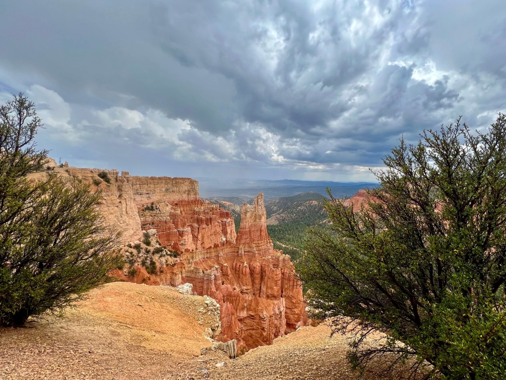
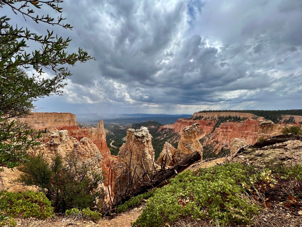
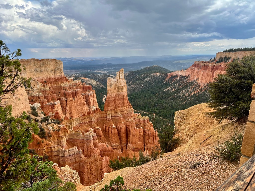
As we drove through the park, we left the rain and wind behind. We stopped at several areas and took photos. The views were breathtaking. It is hard to show depth in a photograph, and without people or cars in the photo to show the enormity of these rock formations, I am not sure one can really appreciate these photos. The best I can say about Bryce Canyon is that you need to be there yourself to really appreciate the enormity of the canyons and the rocks that have been shaped by wind and rain over eons.
We have yet to see Zion National Park in Utah. That is on the list for this week. I don’t know what to expect, as I didn’t know what to expect at any of these places we visited, but I am sure it will be awe inspiring.
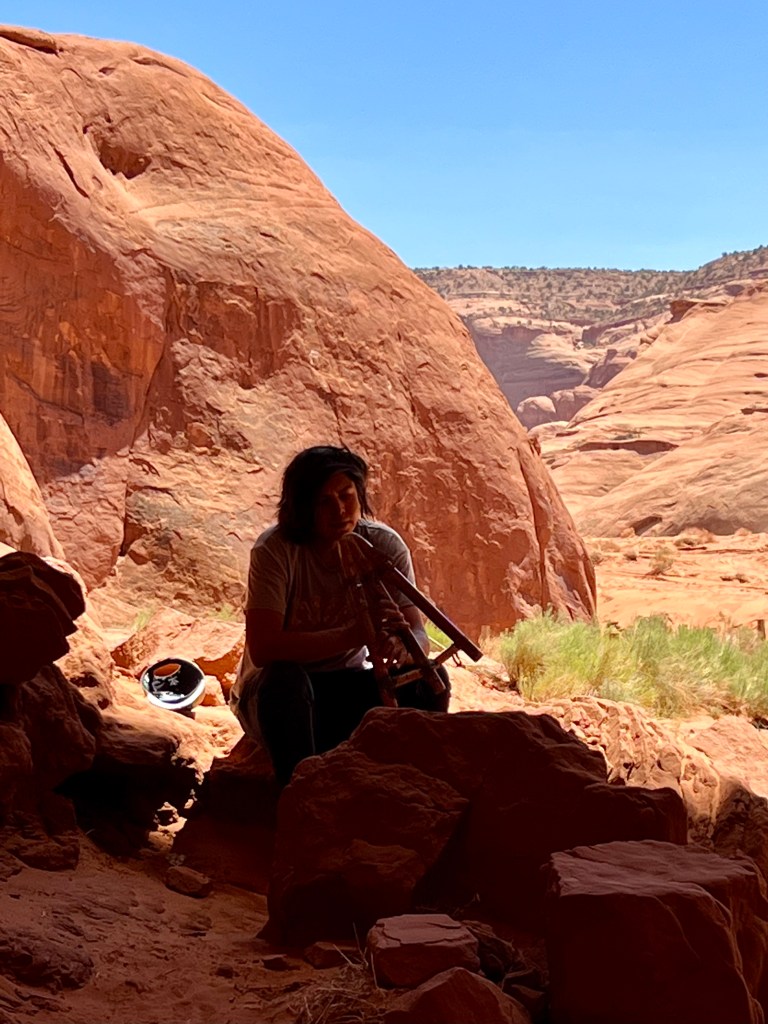
I know these were a lot of photos to go through. I really narrowed them down as best I could. I tried to get as many as I could with people, or a vehicle, or a tree to help give perspective of the enormity of what we were seeing. I’m not sure it even gives the depth. I tried my best.
There ill be more to come on this little Arizona month long vacation. Stay tuned . . . .

Andrea,
This is fabulous. The scenery is stunning. Thanks for taking us with you.
LikeLike
Thank you. I’m so glad to have you traveling with us!
LikeLiked by 1 person
WOW! You guys have had quite an adventure already and there’s still more to come!
The scenery you captured in your photos is breathtakingly stunning and I would love to see it in person one day to fully appreciate all of its beauty.
I love seeing all the photos and I certainly don’t think you have too many. I’d love to see them all!
I can’t wait to read about the next leg of your summer journey. You guys stay safe out there!
LikeLike
Thank you. This has been quite an adventure. Arizona and Utah are unique and beautiful states.
LikeLike
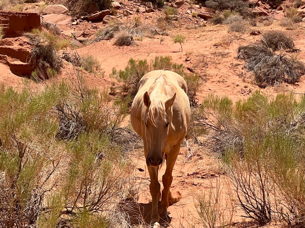
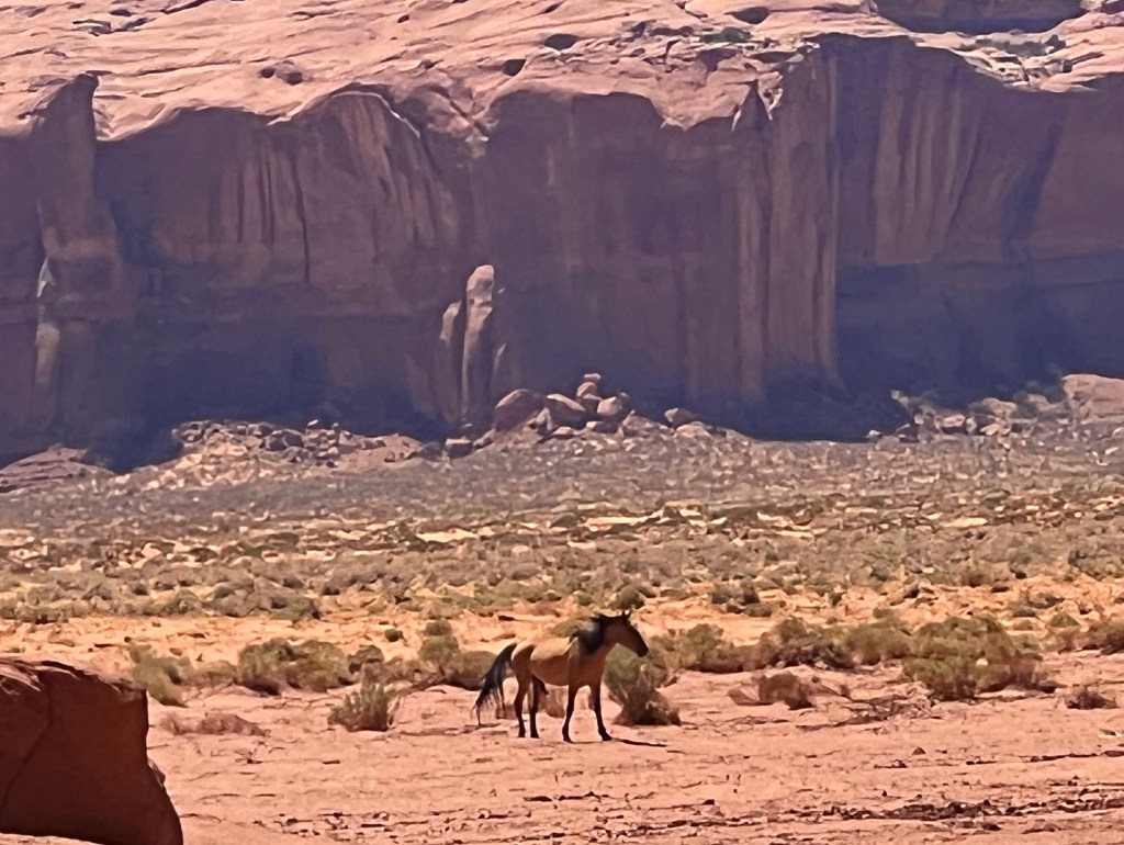
Thanks so much for the awesome tour!! Your photographs are gorgeous! I’ve been to Bryce, Zion and Hoover Dam and all were spectacular! I absolutely loved listening to the flute and can only imagine how wonderful to have heard him playing in that particular setting. I am assuming the photos of the horses meant they were wild? Again, your photos were stunning! I am so looking forward to your upcoming photos.
LikeLike
I’m glad you enjoyed the photos. Our guide said these horses were not wild, just free range. These 2 horses looked pretty healthy, but there was one, whose picture I did not post, looked completely starving. Maybe he was just super old and fragile.
LikeLike
Love traveling with you to places I will never go. Enjoy your trip, I do!
LikeLike
You folks are a visual and storytelling blessing for those of us that can’t travel. Many thanks.
LikeLike