
Put your seatbelt on. I’m going to take you on another ride in northern Arizona-southern Utah! We just ended our two weeks staying in Page, Arizona. Page is a very small, and I mean very small town on the Arizona Utah border. It is the home of Lake Powell and the Glen Canyon Dam. It is a good central point to do day trips around the the area.
We headed our way back into Utah to visit Zion National Park. The park was originally named “Mukuntuweap” meaning straight canyon. Aren’t you glad its name was changed? Although the pioneer, John Wesley Powell, named it that, he arrived after the Mormon pioneers settled there, and they named it Zion, which in Hebrew means, sanctuary or refuge.
The Utah National Park Trips website states, “Few outsiders visited the region until a federal land survey in 1908 first exposed the area to the general public. The natural splendor of the region so struck the surveyors, that they encouraged President Taft to protect this area. In 1909, Taft set aside approximately 16,000 acres for Mukuntuweap National Monument. In 1918 Munkutuweap National Monument became Zion National Monument and in 1919 the named changed again to Zion National Park.”
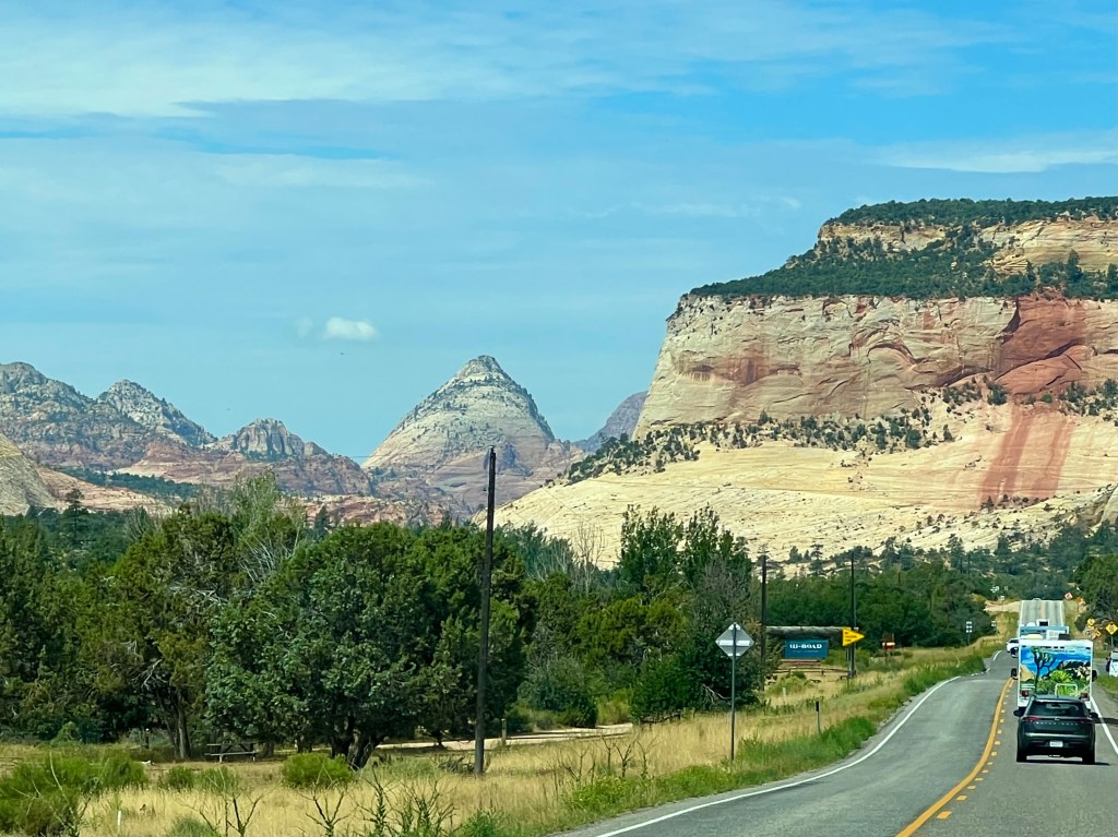
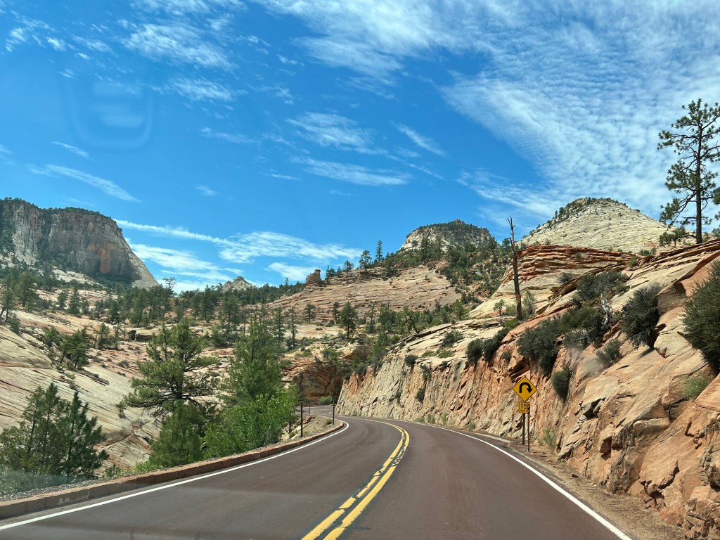
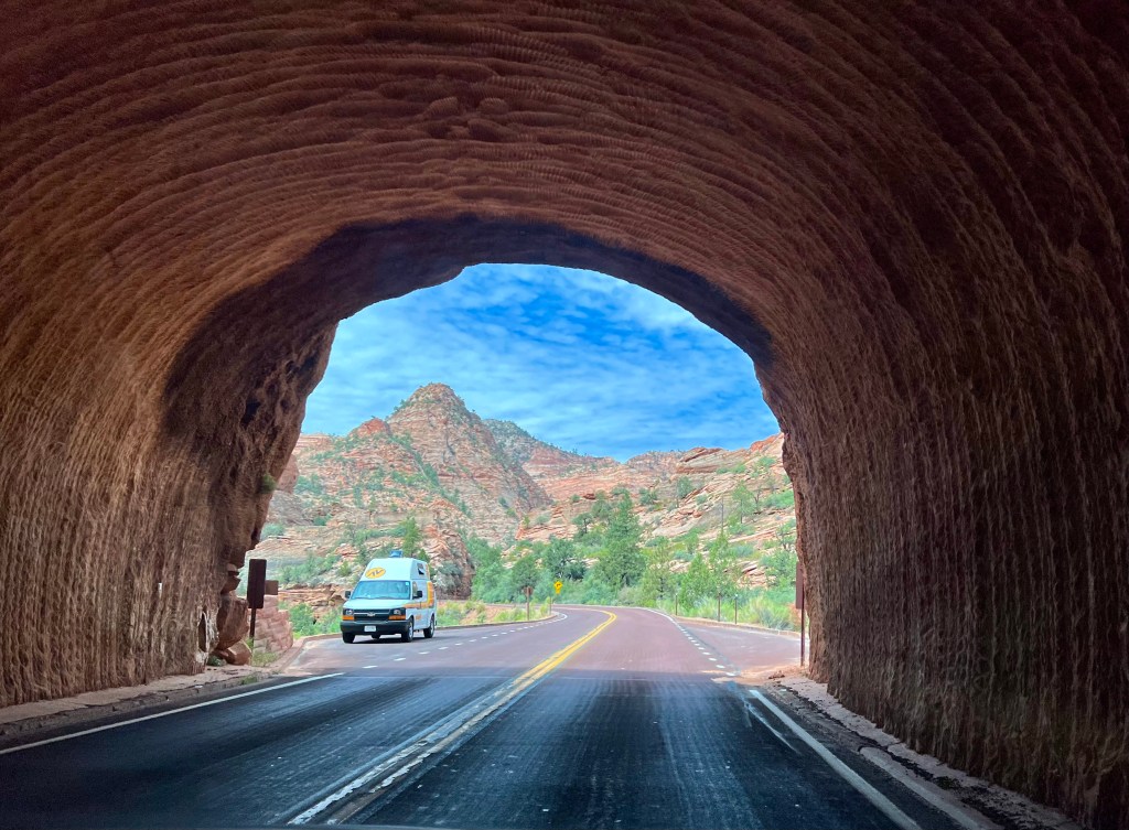
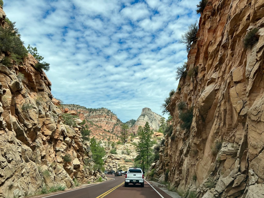
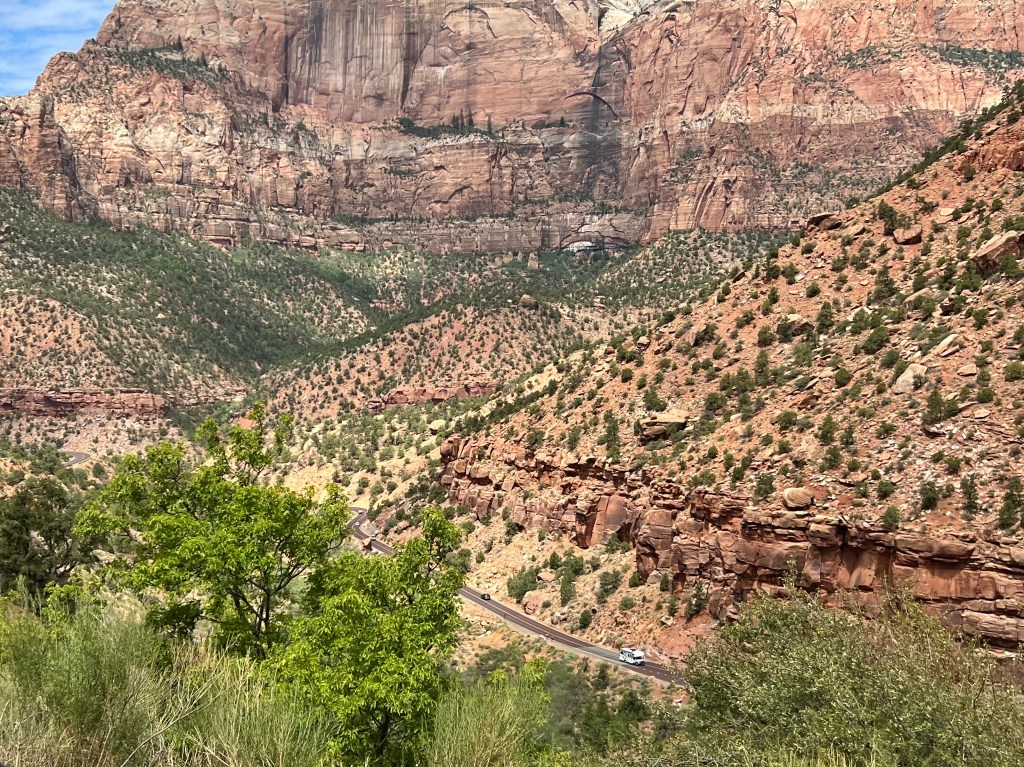
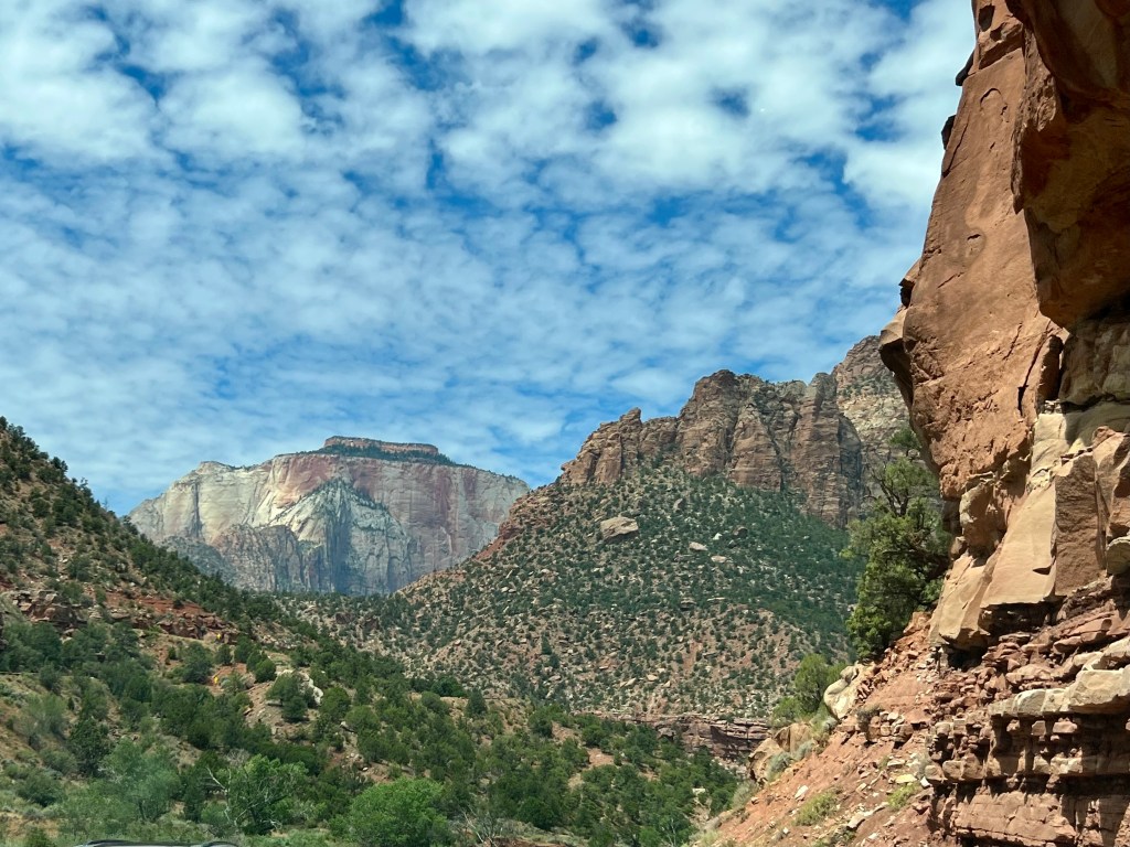
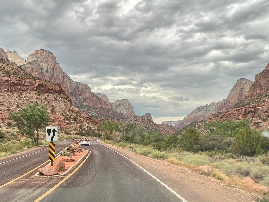
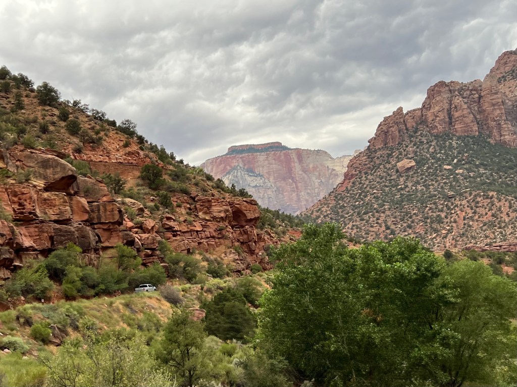
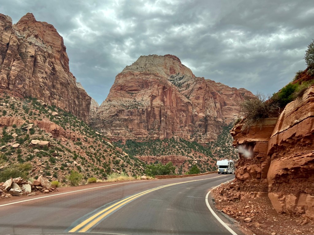
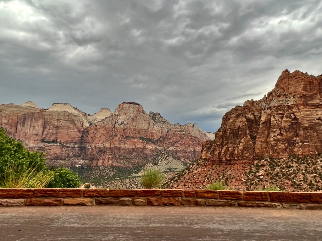
I actually found this park more fascinating driving into and out of the park. The switchback roads expose so many levels and layers to these mountains. There are two tunnels that have to be driven through to reach the park.


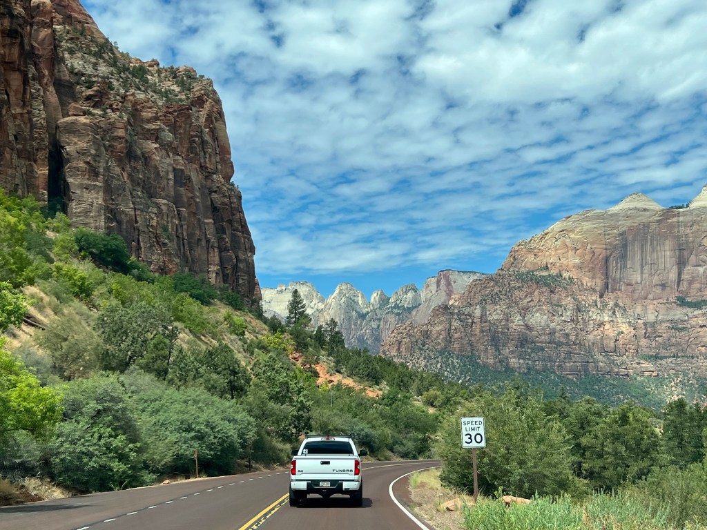
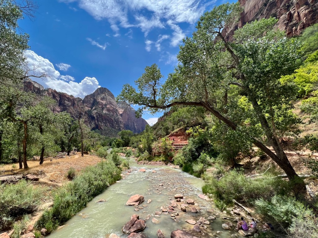
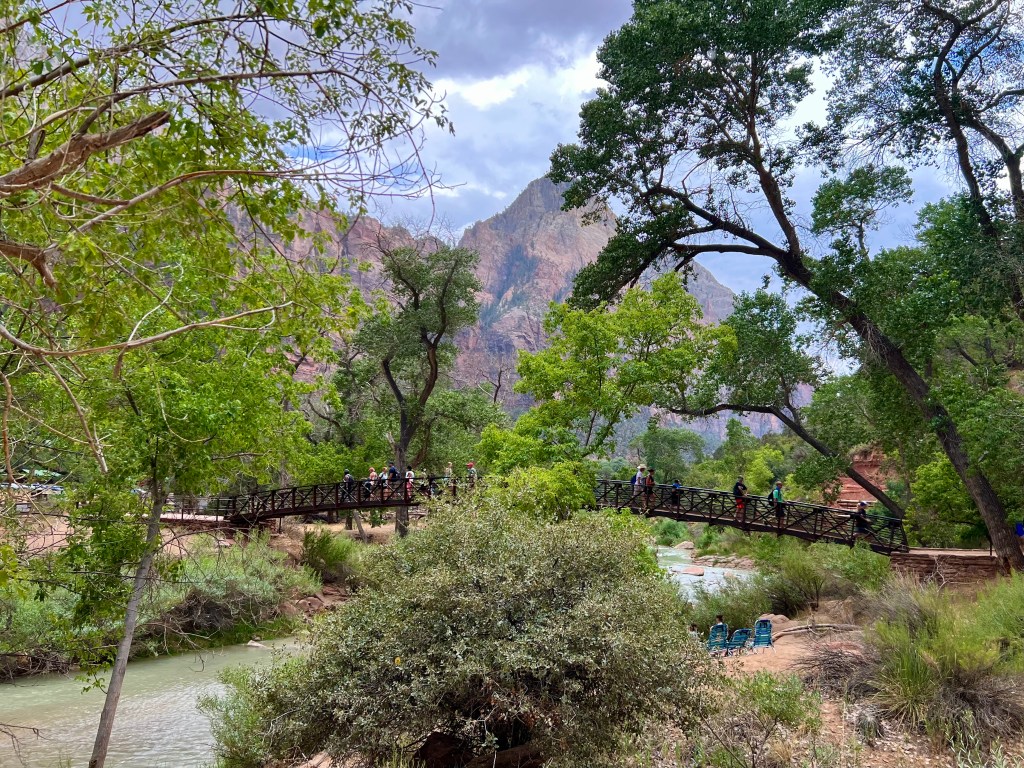
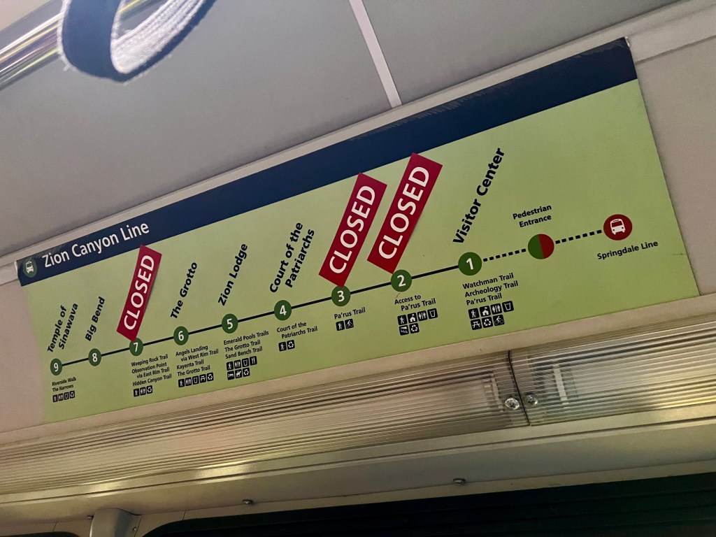
Once in the park, cars are no longer the mode of transportation. We arrived at the visitor center to discover there was no parking available in the lot, and the sign said to go to Springdale, the small town next to the visitors center. We drove out of the park and found a parking lot. We proceeded to park our jeep, and went to the box to pay the fee, and discovered it was $40. Yes, we paid the fee, as parking was a premium. We walked over the bridge and reentered the park. There were buses that drove us around the park. Zion is the only national park that has free shuttle buses to take you through the park. You can get off and on as many of the stops as you want.
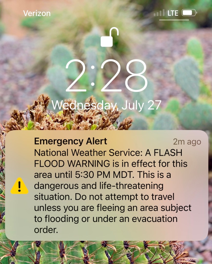
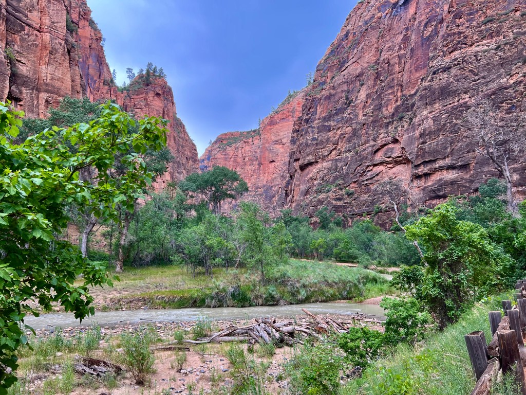
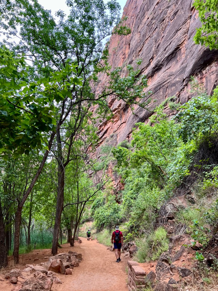
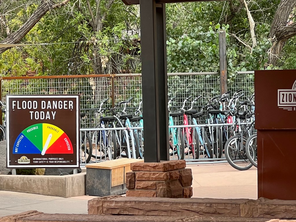
Our first stop was at the Zion Lodge. There was a hiking path that had several levels of difficulty depending on which way you turned after exiting the bridge. We took the least difficult one, as I am not a rock climber! The views were beautiful. As we hiked this path, we could see in the distance the clouds getting dark, and we could hear the thunder in the distance. As we crossed back over the bridge to get to the shuttle bus, the rain that was at a distance was now starting to fall on us. Our final stop on the bus was where the trail lead to the Narrows. If one hikes the Narrows, one is actually going to have to hike through the water. It is the area where the river is narrowed and is a beautiful walk. By the time we got to this furthest destination, there were signs stating that the Narrows was closed to hiking due to the possibility of flash flooding. In fact, a couple of the stops were now closed because the possibility of flash flooding.

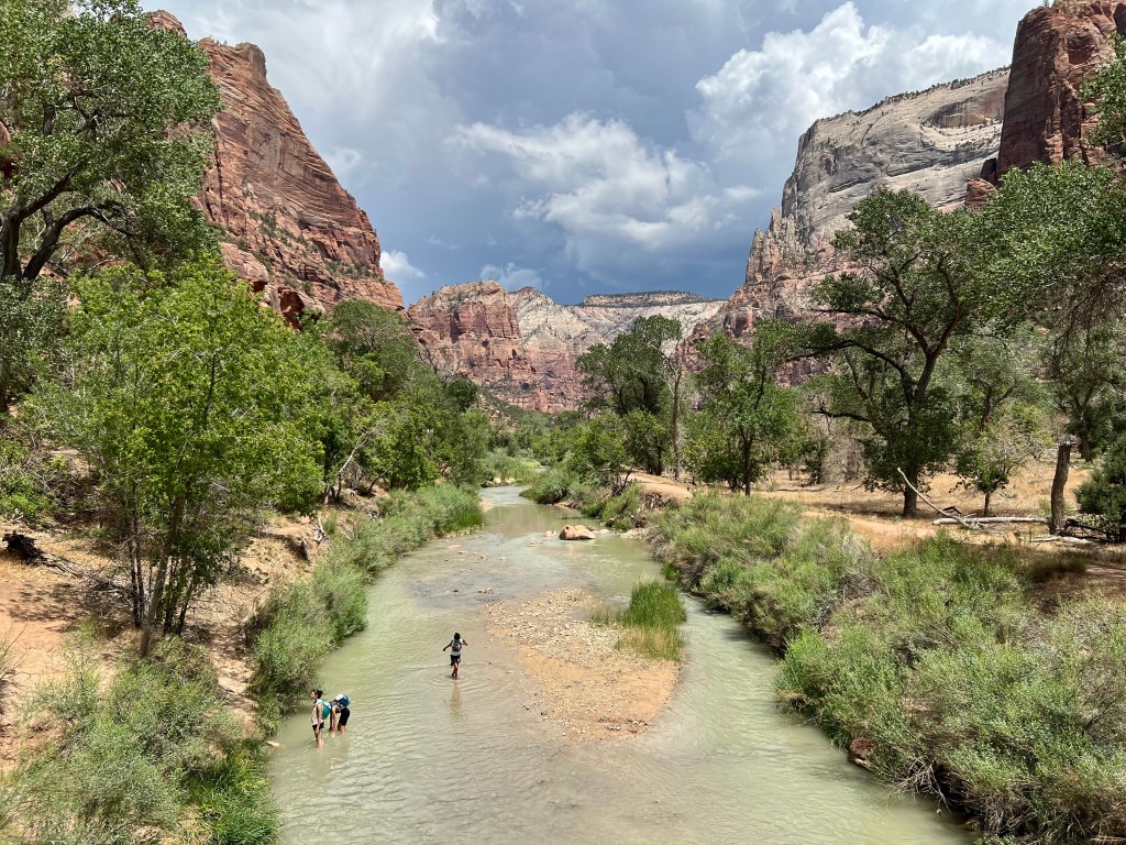

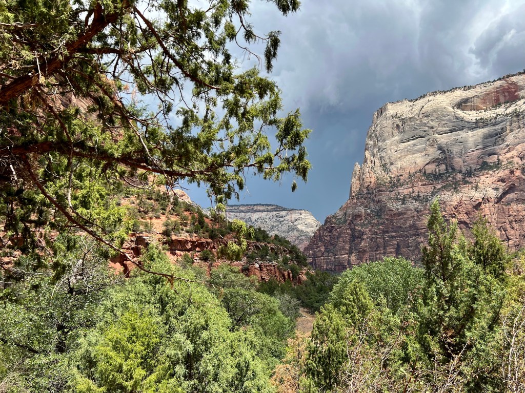

We did hike for a while toward the Narrows, but since there was not ranger around when we headed off, we were not sure how far it was safe to go, or what the threat really was. As we got closer to the river, we decided it was time to head back.

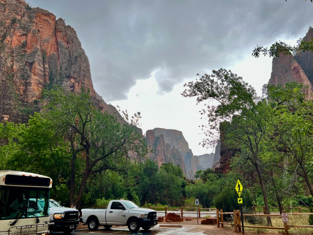
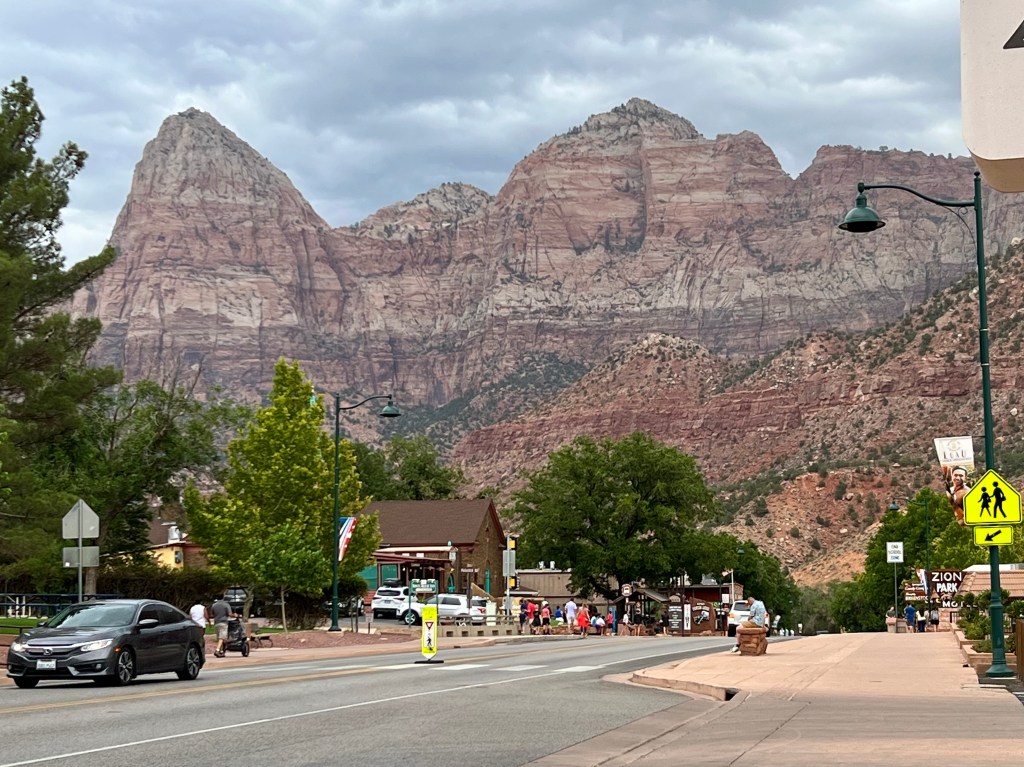
We had not eaten, and the town of Springdale had several restaurants calling our name. We were also quite wet from the rain, and these two old timers were ready to leave. Springdale also has free shuttle buses to take you through town, so we headed out to a recommended restaurant for dinner. When we arrived to our car, we were the only car left in the lot—we got our money’s worth! We had to head back into the park to leave. Fortunately, Dennis has a lifetime National Parks pass. If one paid to get into the park and lost their receipt, they would have to pay again to get into the park to get out of the park! Hang onto your receipt if you are parking outside of the park!

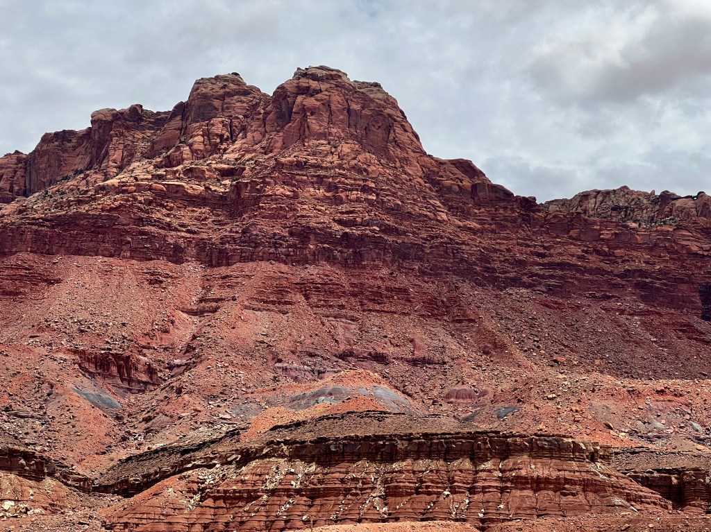
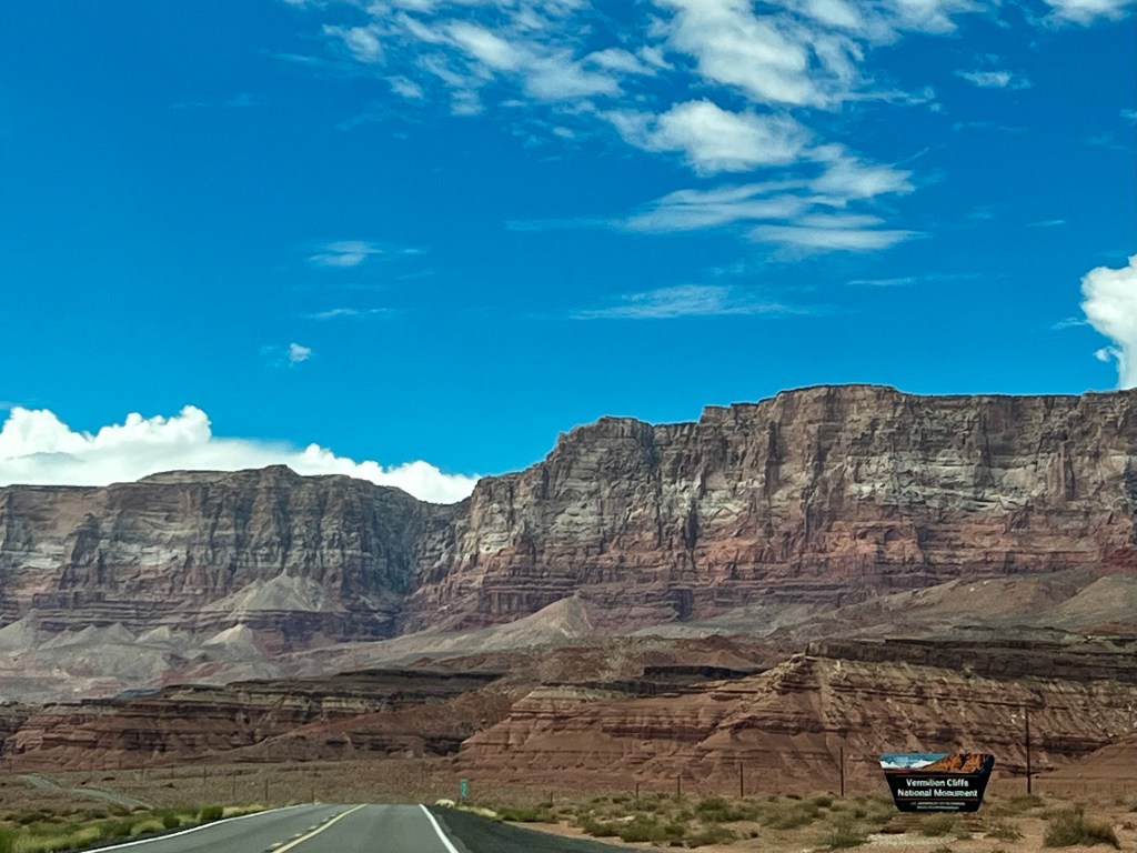
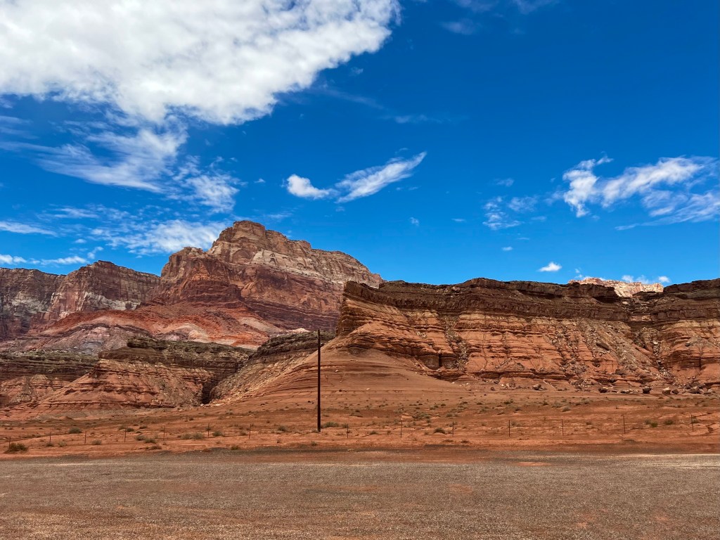
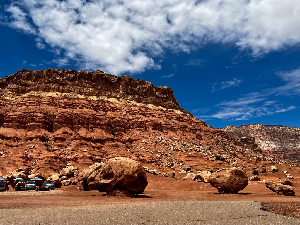
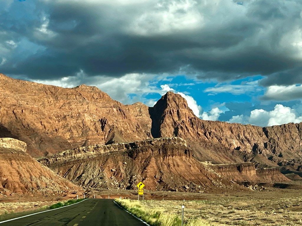
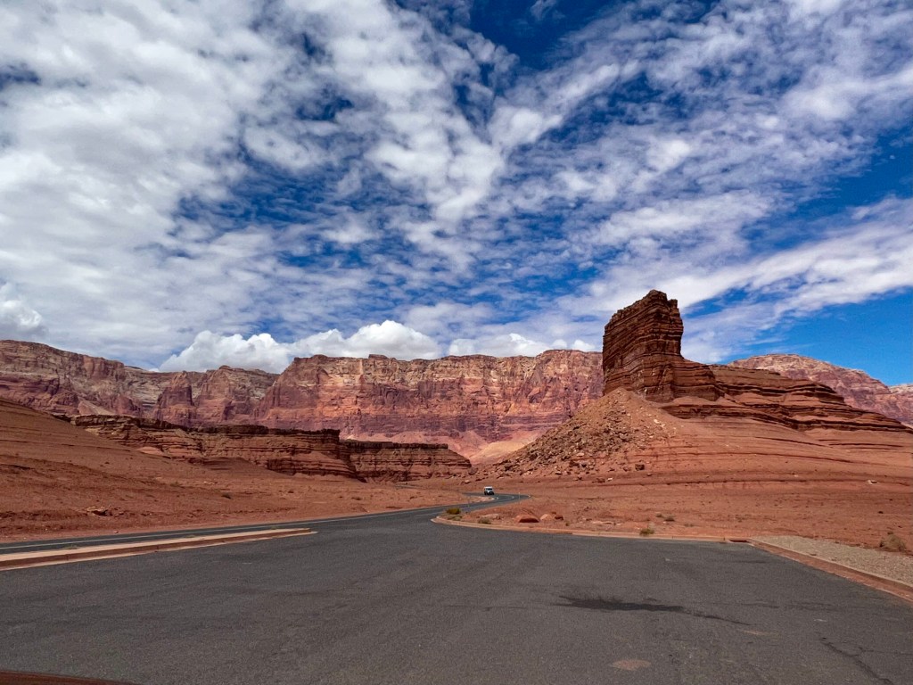
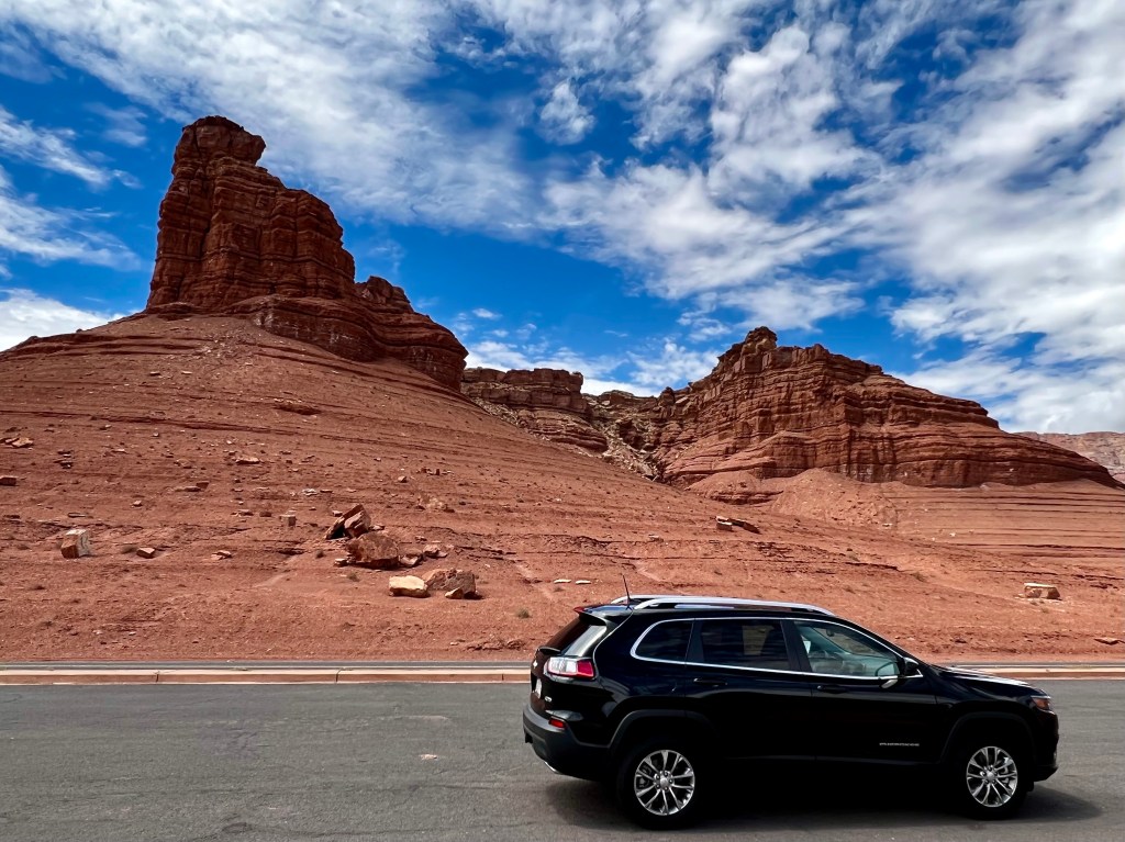
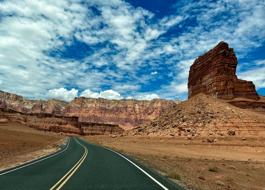
Our next adventure was to see the Grand Canyon from the north. I wasn’t sure I wanted to go to the north rim because I had also seen in my brochures a place called Vermillion Cliffs. What I didn’t realize was that our drive to the north rim would be past the Vermillion Cliffs. Oh my, the views were breathtaking. The definition of the word vermillion is, “a deep, brilliant shade of red” or also a red-orange. Yes, this is the color of the cliffs. The lighting was perfect that day to get photos as the Jeep dashed across U.S. Highway 89A.
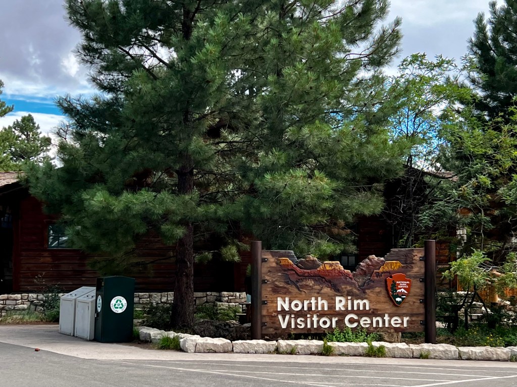
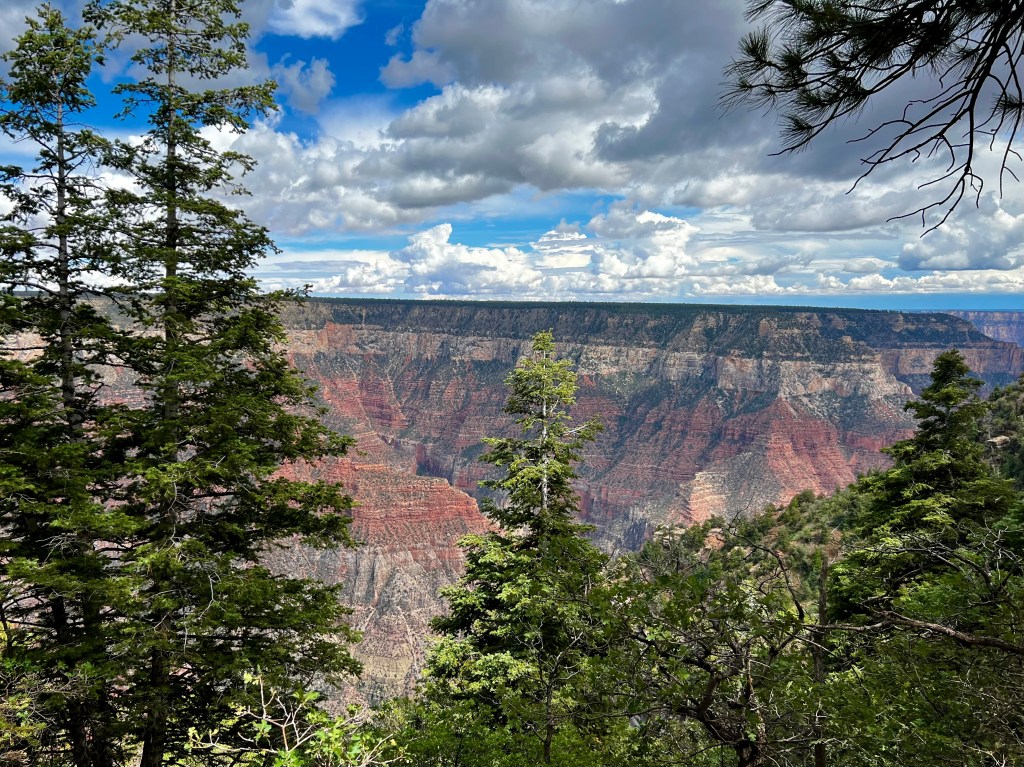
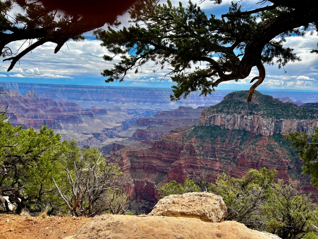
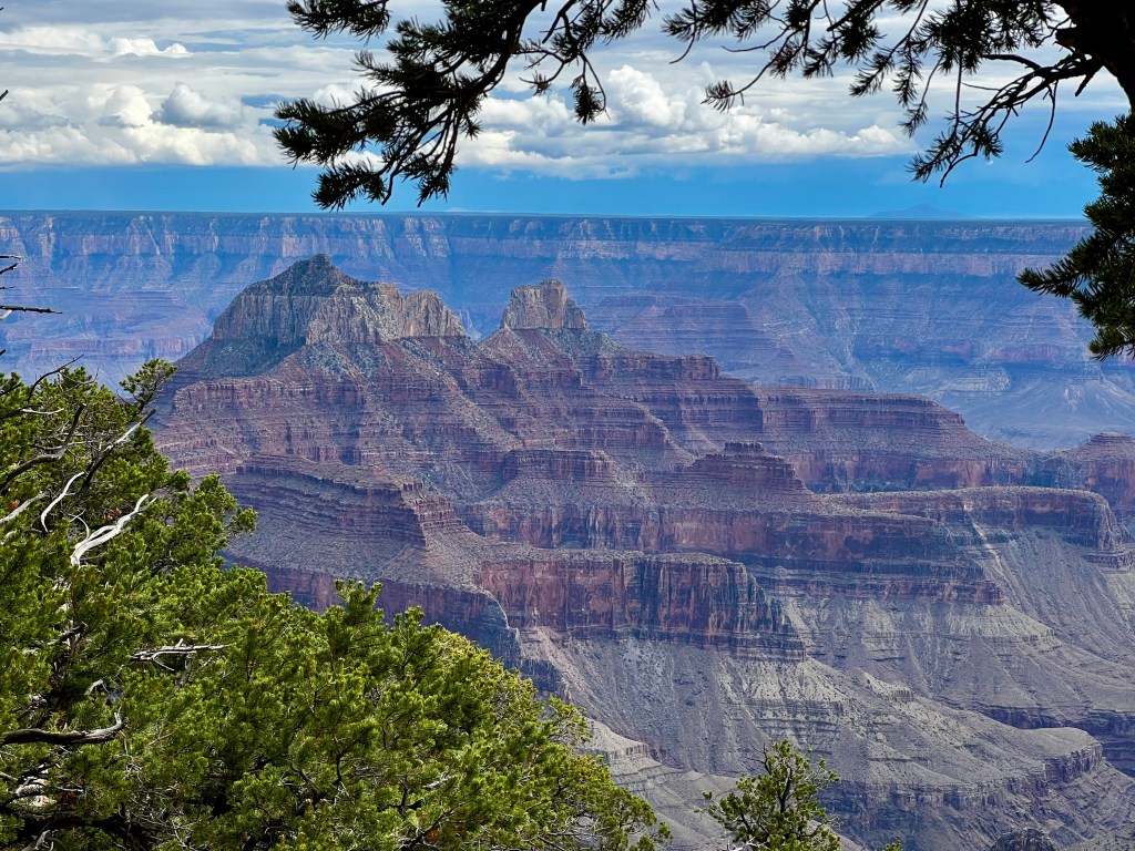
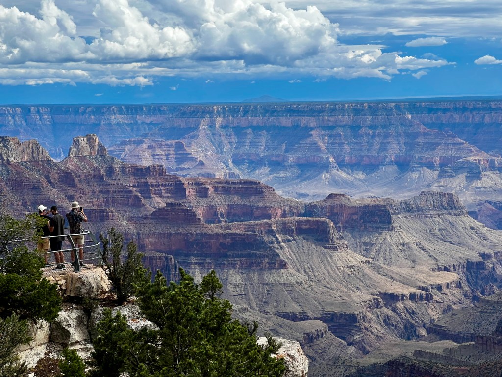
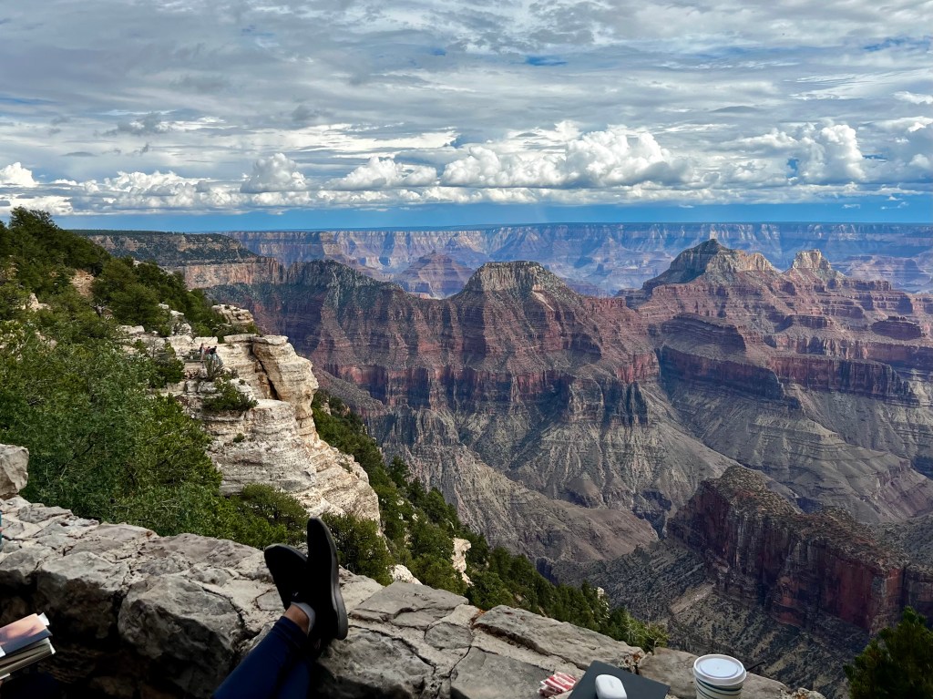
Going to the north rim of the Grand Canyon was not what I expected. It looks nothing like the most visited area, the south rim. Driving to the park was a drive through a forest of Ponderosa Pines. The views at the north rim were breathtaking, and for a person with a fear of heights, a bit terrifying. There aren’t railings along the edges like there are on the south rim. I hiked the Bright Angel Point trail until I was no longer comfortable with the narrow path and no railings. I stayed back and sent Dennis on his way hoping he would return without falling off the cliff!

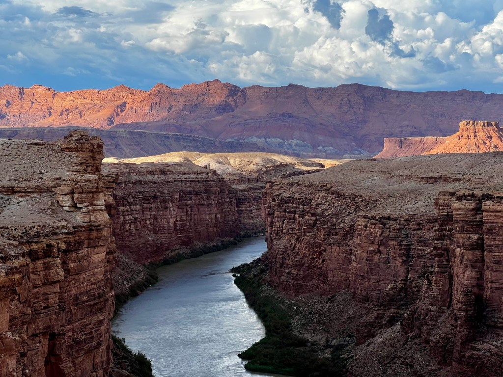
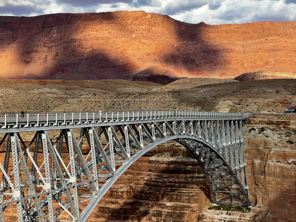
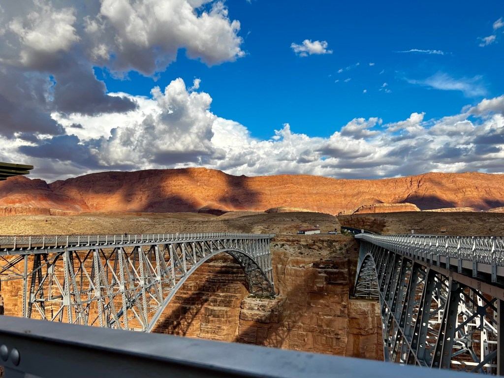
As we returned from the the Grand Canyon we stopped at the Navajo Bridge which crosses the Colorado River. We were next to Marble Canyon, but didn’t have time that day to stop. We went back the following day to see the Marble Canyon area.
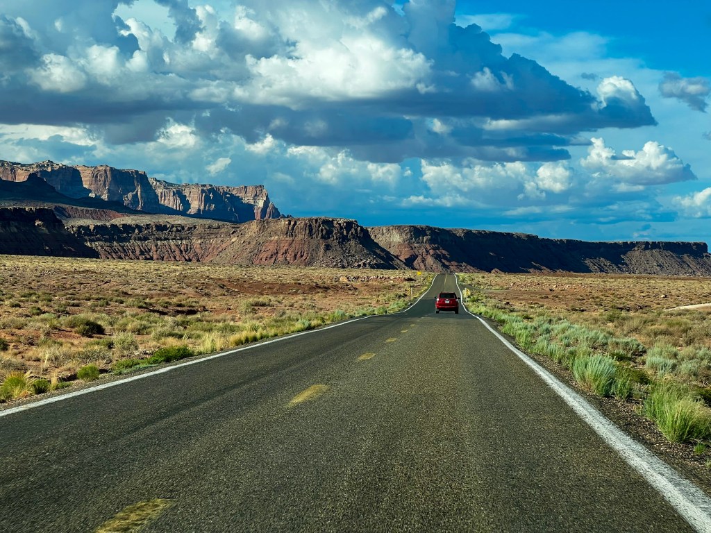

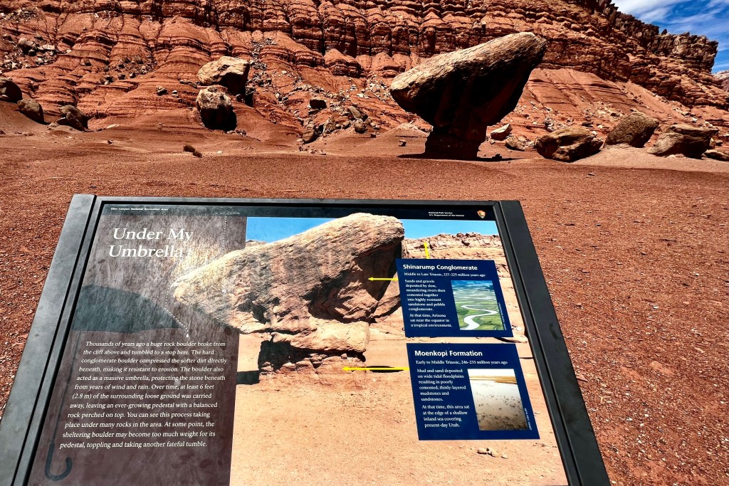


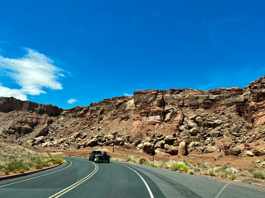
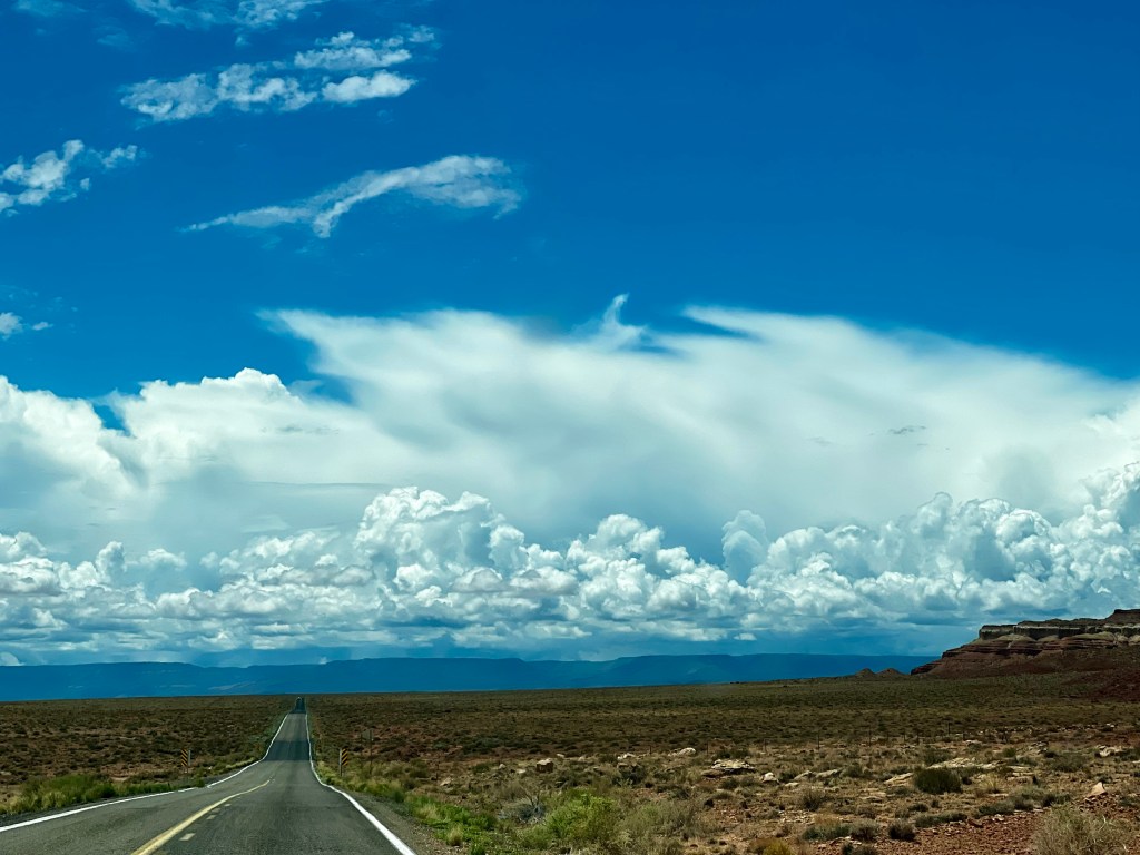
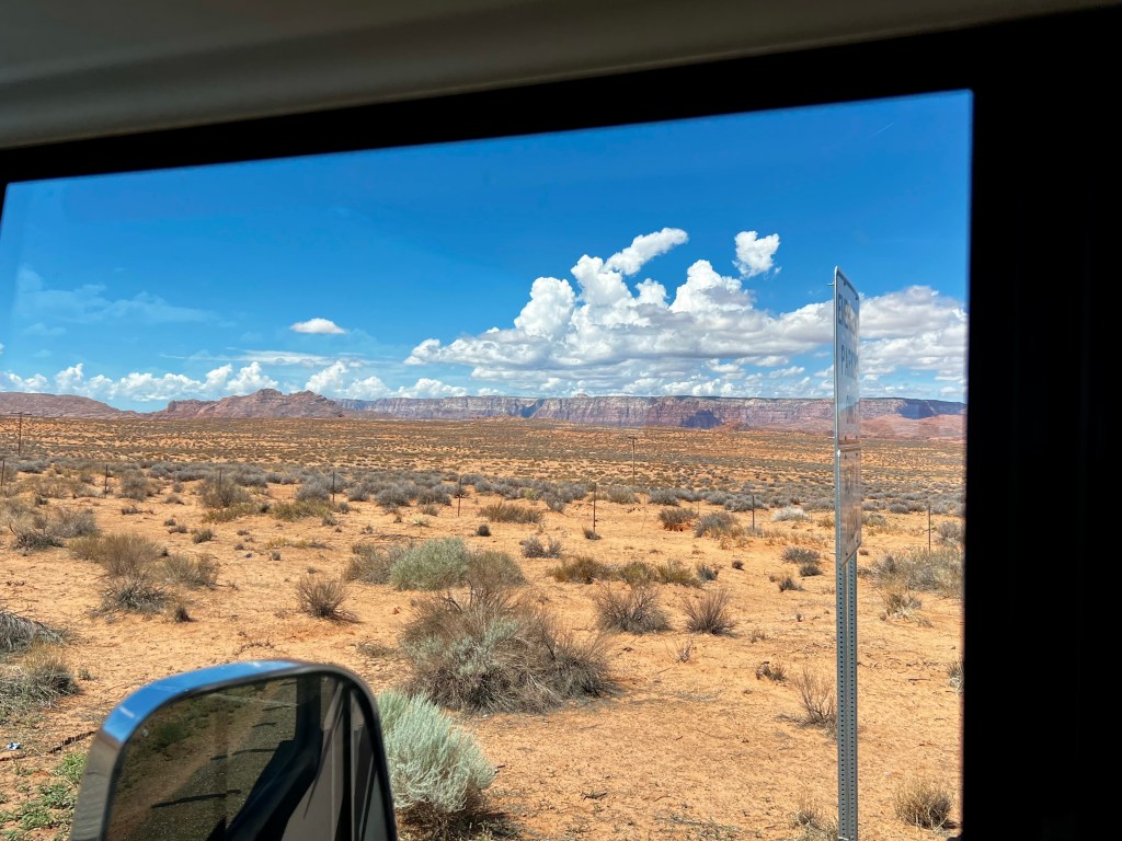
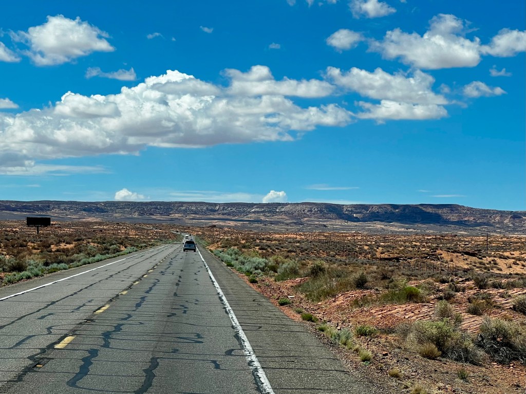
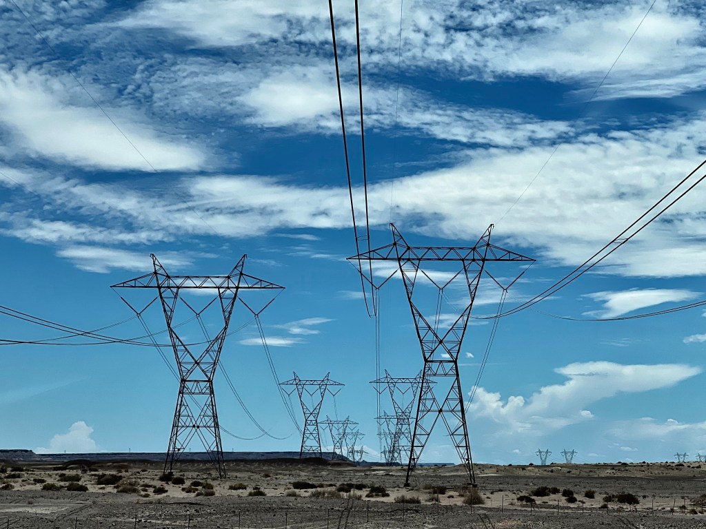
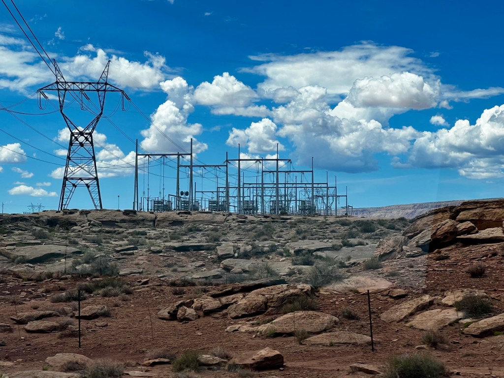
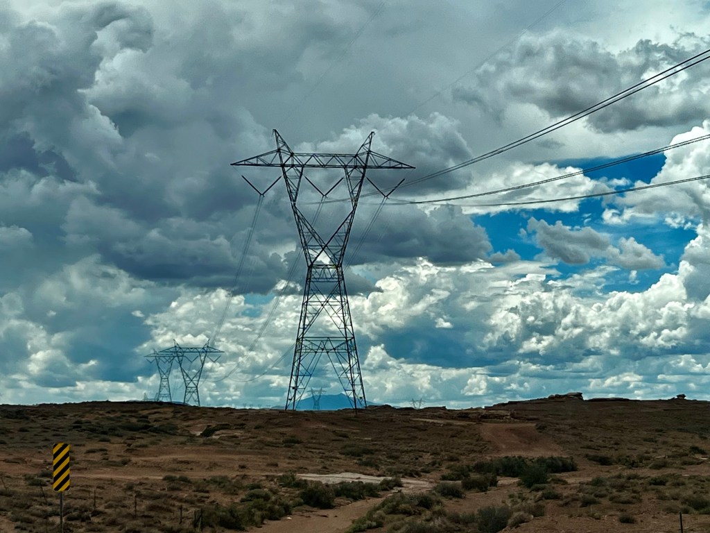
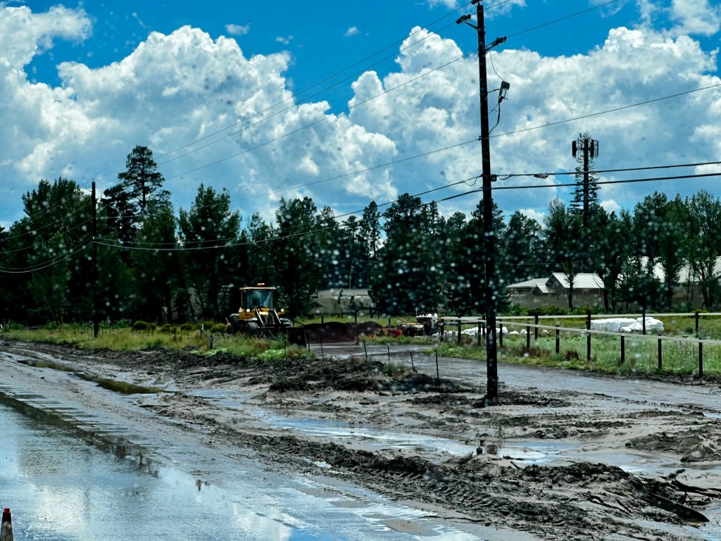
This ended our two week stay in Page, Arizona. We hooked up our Jeep to the RV and headed to Flagstaff. Many of the photos I take are taken while Dennis is driving down the highway. I just snap away looking out the windows. I take a lot of photos and then go to my computer to see if I actually caught some scenes that were whizzing past me. I love taking photos of roads, distant landscapes, power line structures, and clouds. The drive to Flagstaff was no exception. The landscape changed as we drove south. I am fascinated by the electrical lines that have been erected in the mountains–who does this? How do they get those lines running from structure to structure? As we drove into Flagstaff, the clouds were getting heavier.
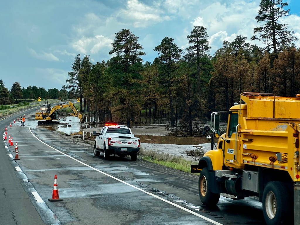
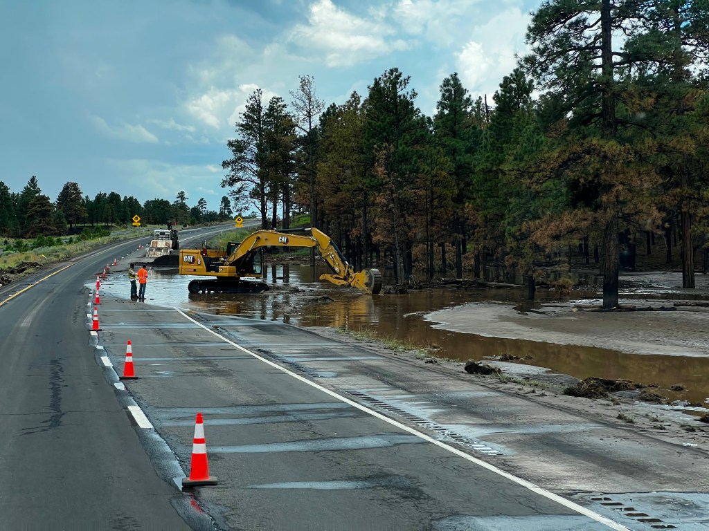
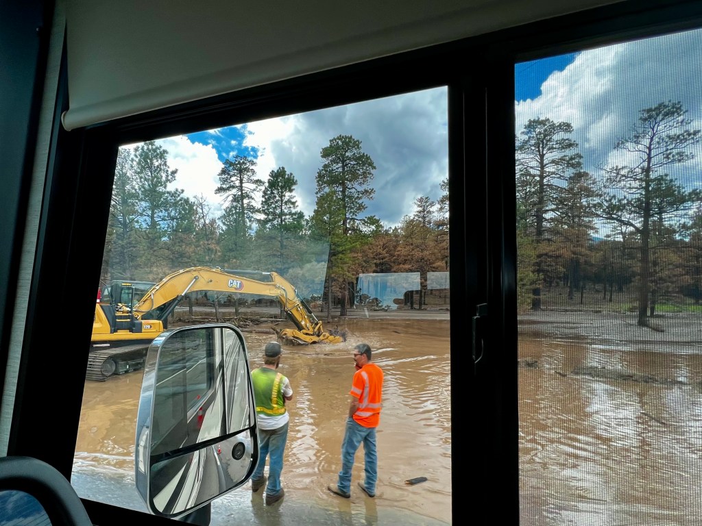
For those who may not be aware, it is monsoon season in Arizona. Flagstaff had a wildfire back a couple months ago. I wrote about this wildfire in a previous blog, because I was caught up in the road closures when this happened. The person who caused the fire was a homeless man who had his truck on the mountain for the night. He had gone to the bathroom and decided to burn his toilet paper and put it under a rock. When he woke up in the morning he saw his smoldering toilet paper had started a fire. He was unable to beat it out with his sleeping bag. He was arrested. When he finally went to court, he was let off because he had no money to pay the fine. Really? He caused $5,000,000 in damages on over 26,000 acres. Now the monsoon season has started and there is flooding down the “burn scar.” This flooding has devastated many homes and has flooded over the highway. One Flagstaff resident who has a virtual river running through her yard said that the most frustrating thing was that they left this man completely off the hook. She said he should have been required to do community service and help sandbag and clean up the flooding mess.
It has been a busy two weeks of seeing as much as two senior citizens could handle driving through the beauty of Arizona and Utah. I have no idea what these next two weeks in Flagstaff will bring. I’m sure this city is full of new adventures for us.

Thanks once again for sharing these fabulous photos! They brought back some happy memories for me when I traveled extremely similar routes as you several years ago. (I even walked across the Navajo Bridge!) The photos of the landscape are so lovely, but I am drawn to the clouds in the photos – spectacular!! Can’t wait to see where you visit in Flagstaff!
LikeLike
Springdale is beautiful! You got many great photos of the area. What an adventure you had.
LikeLiked by 1 person
Thank you. We sure have enjoyed this trip.
LikeLiked by 1 person